HOW TO
Fill a TIN surface with new values from a feature layer that varies in elevation
Summary
Triangular irregular networks (TIN) surfaces are based on a collection of nodes or points that are transformed into a network of interconnected triangles that represent the shape of the surface.
In some instances, trying to modify a specific area of a TIN surface produces erroneous results, for example, when using the TIN Editing tool with new values from a polygon, line, or point area that vary in elevation. This is typically due to the underlying node network trying to modify to include the new nodes which are created above the area of interest. This creates improper or very few new node connections (triangles) and does not provide the expected surface change.
A way to modify the surface with a shape or area containing non-constant values is described below.
Procedure
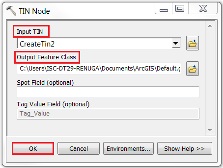
Follow the instructions to fill values of a given area on the TIN surface with the values of, in this example, a polygon which also varies in elevation.- In ArcMap or ArcScene, run the TIN Node tool to export the nodes of a TIN dataset to a point feature class with the parameters specified as below:
- For Input TIN, select the TIN dataset.
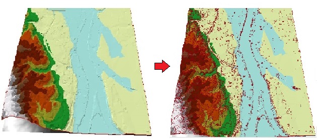
- Specify the output feature class name and location > click OK. The resulting image displays points features on the TIN surface.
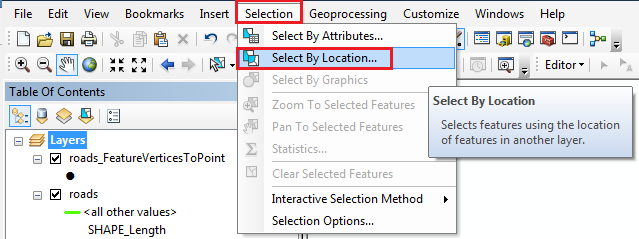
- Click the Editor menu on the Editor toolbar > Start Editing.
- On the main ArcMap menu, click Selection > Select By Location to open the Select By Location dialog box.
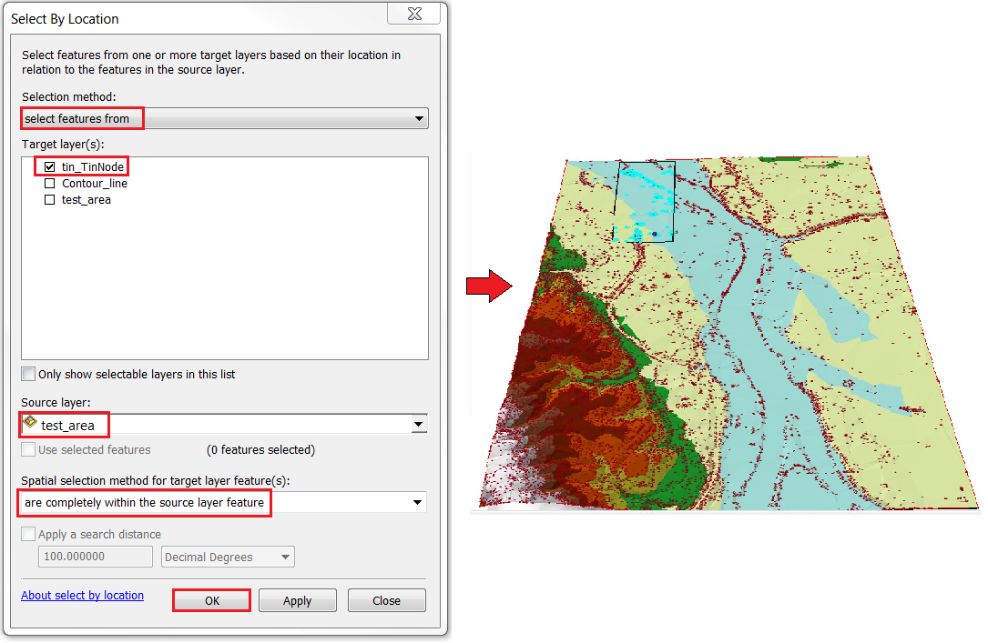
- In the Select By Location dialog, set the following parameters:
- For Selection method, click the drop-down arrow, and select the select features from option.
- For Target layer(s), check the node feature layer.
- For Source layer, select the polygon layer.
- For Spatial selection method for target layer feature(s), select are completely within the source layer feature.
- Click Apply to select all of the nodes that fall within the polygon area.
- Press Delete on the keyboard to delete the selected points, and save the edits on the Editor toolbar.

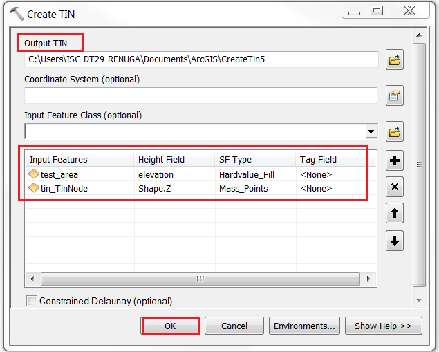
- Run the Create TIN tool with the parameters specified as below:
- Specify the output name and location.
- For Input Feature Class, select the edited nodes layer and the polygon with Z values.
- Ensure that the SF Type (surface feature) for the polygon is Hardvalue_Fill or Softvalue_Fill, and not Soft_Replace or Hard_Replace which creates a constant value.
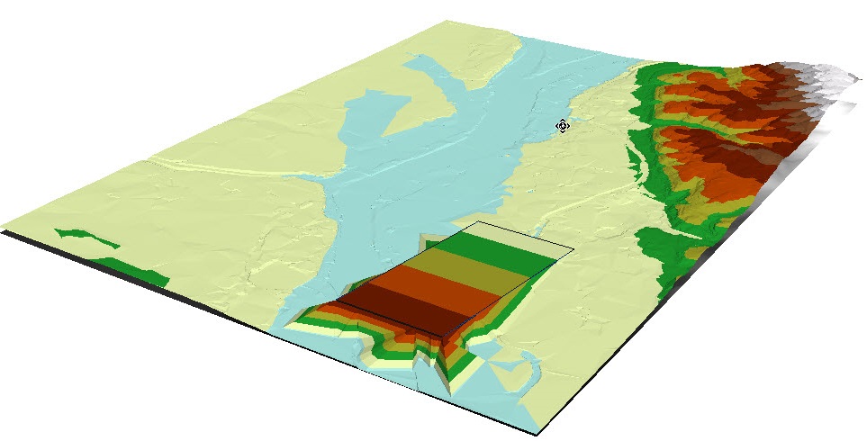
- Click OK. The final output shows the TIN dataset with new values in the polygon area.
Article ID:000016882
- ArcMap
Get help from ArcGIS experts
Download the Esri Support App
Related Information
Discover more on this topic
Search for related information
Find training related to this topic
Explore ideas and give feedback