HOW TO
Edit feature services from ArcGIS Server 10.5.x that have m-values in Collector for ArcGIS
Summary
M-values are a geometry property of spatial data that are used to store route data. Certain clients block editing features that have m-values so that the existing m-values do not get lost when editing the geometry of these features. This presents a challenge in using Collector for ArcGIS, as it is not possible to edit these features.
Note:
Please note that there is an existing enhancement request marked as "In Product Plan" for this functionality.
ArcGIS Enterprise 10.5.x introduced an additional property that affects editing feature services that have m-values. This setting is 'Allow geometry updates without m-value'. This property can be used on layers in the feature service that have been enabled to store m-values, but the m-values are not being used when editing in Collector for ArcGIS. When feature geometries are edited through the feature service, NaN m-values are inserted if the client does not provide them. Therefore, this new setting allows for editing features services in Collector that have m-values coming from ArcGIS Server 10.5.1.
Procedure
Before beginning
- Check whether the ArcGIS Server feature service has m-values:
- Go to the REST endpoint of the feature service.
Example:http://sampleserver6.arcgisonline.com/arcgis/rest/services/Military/FeatureServer
- Click a specific layer in the feature service.
Example:http://sampleserver6.arcgisonline.com/arcgis/rest/services/Military/FeatureServer/4
- Look for the HasM property. If this is true, the feature service has m-values. If this is false, then the feature service does not have m-values.
Example: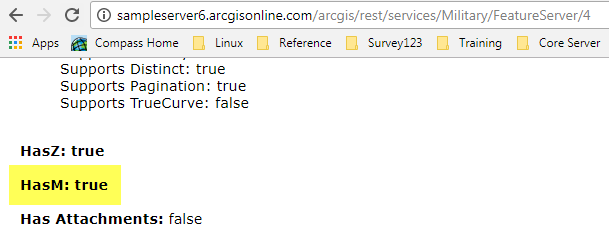
- Go to the REST endpoint of the feature service.
- Check whether the data has m-values by using the following method:
- Browse to the location of the feature class in ArcCatalog.
- Right-click the feature class, and click Properties.
- On the General tab, the Geometry Properties section lists whether the features have M- or Z-values
Example: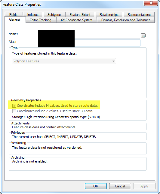
The following documentation explains the workflows for using the Allow geometry updates without m-value property:
Configure editable feature services that contain m-enabled layers
Enabling the property while publishing
- Click File > Share As > Service. Continue through the prompts until the Service Editor window opens.
- Select Feature Access on the service.
- In the Feature Access details pane, check the box next to Allow geometry updates without m-value.
Enabling the property on an existing ArcGIS Enterprise 10.5.1 feature service
- Open ArcGIS Server Manager and log in as the owner of the feature service or as the ArcGIS Server administrator.
- Click Services > Manage Services.
- In the Services module, click the name of the feature service to insert NaN m-values when the client doesn't supply one.
- In the Edit module, click Capabilities.
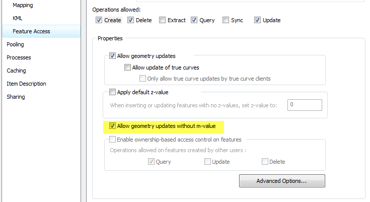
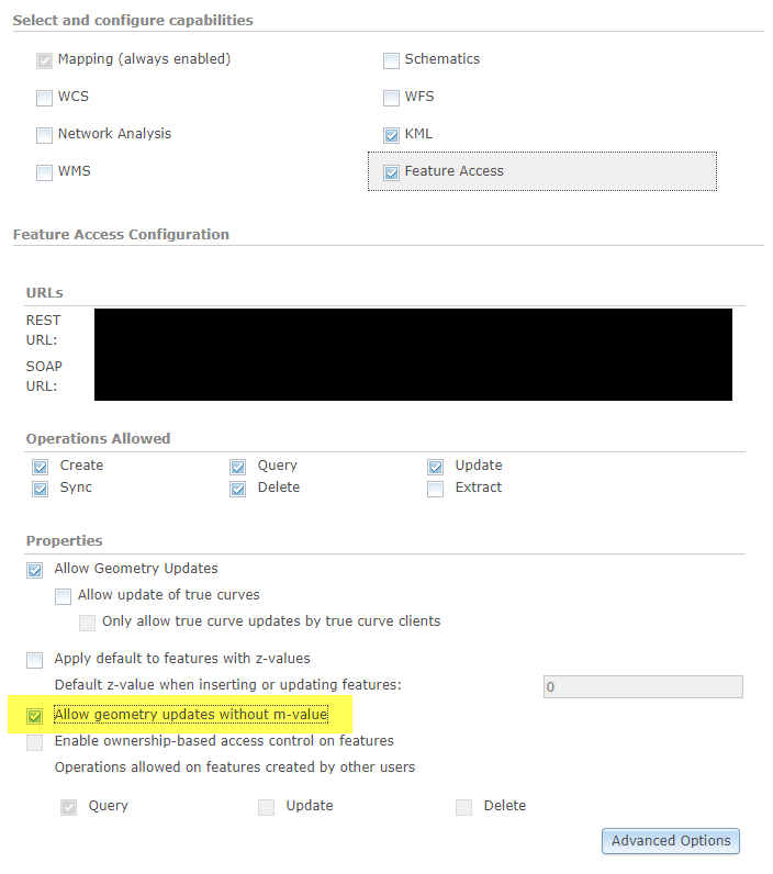
- Click the Feature Access option (the name, not the check box) under the Select and configure capabilities window. This displays the feature service properties.
- Check the Allow geometry updates without m-value check box.
- Click Save and Restart to apply the changes to the service.
Note:
To remove m-values entirely, this can be achieved with the following workflow: How To: Remove Z- and/or M-values from a feature class
Article ID:000016652
- ArcGIS Server
Get help from ArcGIS experts
Download the Esri Support App
Related Information
Discover more on this topic
Search for related information
Find training related to this topic
Explore ideas and give feedback