Frequently asked question
Why does the parcel misclose information differ between the selected and open versions of the parcel?
Answer
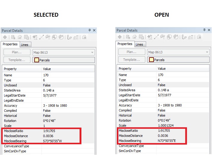
The difference between the starting and closing coordinates of the parcel is referred to as the parcel misclose, which is a measure of the accuracy of the parcel dimensions. In some instances, the misclose properties (MiscloseRatio, MiscloseDistance, MiscloseBearing) differ between the selected parcel and the open version of the parcel.
This is because:
- The selected parcel is based on the join/fit of the parcel in the rest of the parcel fabric, which is the misclose of the geometry. The misclose information is then stored in the attribute table because it is a part of the parcel layer.
- The open version of the parcel is based on the calculated misclose value, which is based on the COGO attributes of only that parcel, and none of the other parcels around it.
The images below show the difference in the misclose information of the same parcel fabric when selected versus when the parcel is opened:
Article ID:000015775
- ArcMap
Get help from ArcGIS experts
Download the Esri Support App
Related Information
Discover more on this topic
Search for related information
Find training related to this topic
Explore ideas and give feedback