HOW TO
Create numbered symbols on a map to represent points of interest using ArcGIS Pro
Summary
Numbered symbols can be created on a map to display locations, such as points of interest or place markers, by using symbology and labeling options available in ArcGIS Pro.
Procedure
To create numbered symbols for a points of interest map, follow the steps provided below.
- In ArcGIS Pro, add a new field in the attribute table of the layer and within the field, specify the unique numbers for each point of interest on the map.
- Navigate to the Labeling tab, select the field created in Step 1 from the Field drop-down list in the Label Class group, and select Centered Point in the Label Placement group.
Note:
Ensure the Label Features In This Class check box is checked.
- Click the Label option to display the unique numbers as labels. Adjust the font and size of the labels so the labels are clearly visible when viewing the map.

- To set a suitable symbol for the labels, click the default point symbol of the layer in the Contents pane to open the Symbology pane.
- In the Symbology pane, select a symbol, such as a circle or square, and set the color and size of the points to fit the labels.
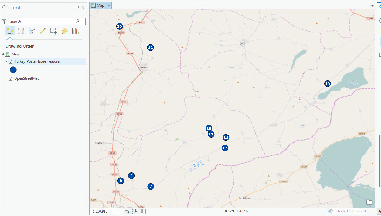
The points on the map are displayed as numbered symbols, as seen in the sample map below.
Article ID: 000015202
Software:
- ArcGIS Pro 3 0
- ArcGIS Pro 2 8 x
- ArcGIS Pro 2 x
Get support with AI
Resolve your issue quickly with the Esri Support AI Chatbot.


Related Information
Discover more on this topic
Search for related information
Find training related to this topic
Explore ideas and give feedback
Get help from ArcGIS experts
Start chatting now