HOW TO
Create a data dictionary of a file geodatabase using the X-Ray for ArcCatalog add-in
Summary
Data dictionary is a catalog or table containing information about the datasets stored in a database. The data dictionary might contain the full names of attributes, meanings of codes, scale of the source data, accuracy of locations, and map projections used. Creating a data dictionary allows other users in an organization to view the information about the data.
Data dictionaries are also available online. However, at times users are not using the latest version, therefore the database schema is different. The X-Ray for ArcCatalog add-in provides the tools to create an HTML document of the data dictionary for any database.
The following instructions describe how to create a data dictionary of a file geodatabase using the X-Ray for ArcCatalog add-in.
Note:
The X-Ray for ArcCatalog add-in requires an ArcGIS Desktop Standard or Advanced license.
Procedure
Note:
Ensure data is in a file geodatabase before creating a data dictionary and the extension for X-Ray Extension for Geodatabases is enabled.
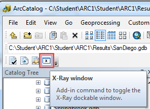
- In ArcCatalog, click the X-Ray window button to open the X-Ray for Geodatabases window.
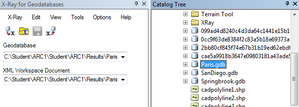
- In Catalog Tree, select the file geodatabase for the data dictionary creation. This populates the geodatabase field in the X-Ray for Geodatabases window.
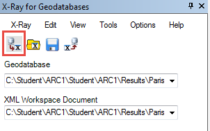
- Click the Export GDB to XML Workspace button.
- Click View > Data Dictionary.
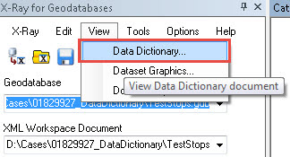
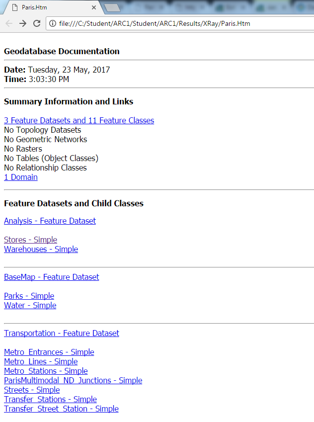
The HTML file of the geodatabase documentation opens in a web browser.
Article ID: 000014210
- ArcMap 10 6
- ArcMap 10 0
- ArcMap 10 x
- ArcMap 10 7
Get support with AI
Resolve your issue quickly with the Esri Support AI Chatbot.


Related Information
Discover more on this topic
Search for related information
Find training related to this topic
Explore ideas and give feedback
Get help from ArcGIS experts
Start chatting now