HOW TO
Determine the distance between a point feature and the nearest point feature in another layer
Summary
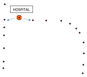
The instructions provided describe how to determine the distance between the nearest point features from two different layers. For instance, to find the nearest distance between point features from a School layer and a Hospital layer.
Procedure
There are two ways to do this, by using geoprocessing tools, or by creating a spatial join.
Use geoprocessing tools
Use the Near tool or the Generate Near Table tool. Refer to ArcMap: Near and ArcMap: Generate Near Table for more information on how to use these tools.
Note:
The Near tool and the Generate Near Table tool are only available with an ArcGIS Desktop Advanced license.
Alternatively, use the Point Distance tool to calculate the distance between all point pairs in two point layers. Refer to ArcMap: Point Distance for more information.
Create a spatial join
Before creating the join, re-project the layers and data frame to have the same projection. Use either the Batch Project or the Project tool to change the coordinate system of the input layer. Refer to ArcMap: Batch Project and ArcMap: Project for more information.
- Create a spatial join by right-clicking the desired layer in the Table Of Contents > Joins and Relates > Join.
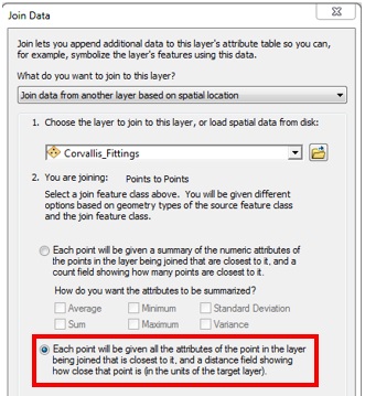
- In the Join Data window, select another layer to join with the desired layer.
- In the second option of the dialog, under You are joining: Points to Points, select the Each point will be given all the attributes of the point in the layer being joined that is closest to it, and a distance field showing how close that point is (in the units of the target layer). option.
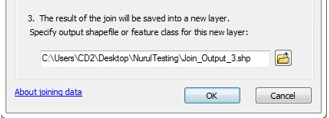
- Specify the output location, and click OK. A new layer containing the nearest distances is created.
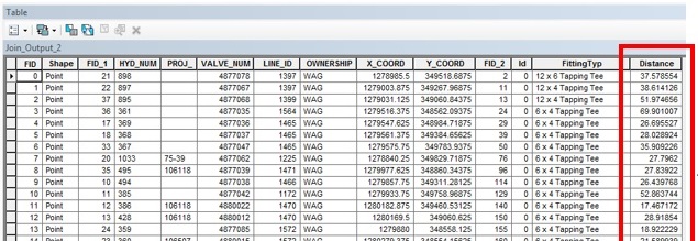
- To determine the distance between the features, right-click the newly created layer, and select Open Attribute Table. In the table, the distance values are created in the Distance field.
Note:
To convert the distances' values to other units of measurement, create a new field with the Double data type, and populate the distance values using the Field Calculator. Refer to ArcMap: About distance units and editing for more information.
Article ID: 000012869
- ArcMap
Get support with AI
Resolve your issue quickly with the Esri Support AI Chatbot.


Related Information
Discover more on this topic
Search for related information
Find training related to this topic
Explore ideas and give feedback
Get help from ArcGIS experts
Start chatting now