PROBLEM
The Measure tool is disabled in ArcMap
Description
When accessing the Tools toolbar in ArcMap, the Measure tool is disabled.

Cause
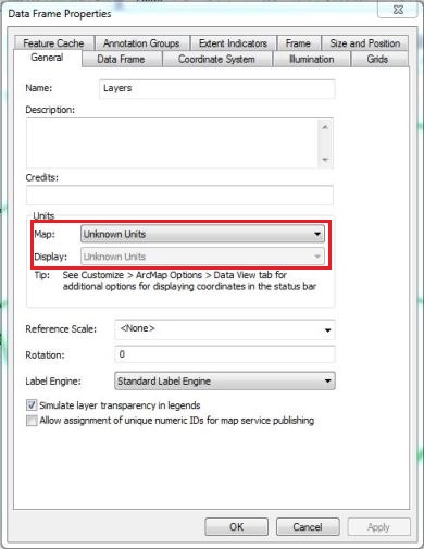
This issue occurs because the map does not have known units.
Solution or Workaround
Set the map unit of the data frame
Set the map unit of the data frame with a known unit such as Meters or Miles.
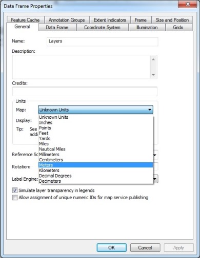
Note:
The map units are determined by the data frame's coordinate system.
Specify a coordinate system
- Specify a coordinate system for the data frame.
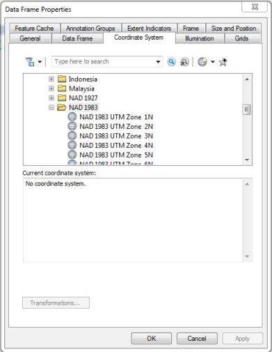
- After the coordinate system of the data frame is specified, the map unit is also set with a known unit.
Note:
The data frame's coordinate system is usually determined by the first layer added to the map. Apply a projected coordinate system (PCS) to measure areas. Refer to ArcMap: Specifying a coordinate system for more information on changing and assigning a coordinate system.
Article ID:000012430
Software:
- ArcMap
Get help from ArcGIS experts
Download the Esri Support App
Related Information
Discover more on this topic
Search for related information
Find training related to this topic
Explore ideas and give feedback