PROBLEM
The Pan To command in an attribute table does not respect the current scale when panning a feature
Description
ArcMap can select any feature and navigate a map to the feature with commands such as Zoom To or Pan To from the attribute table.
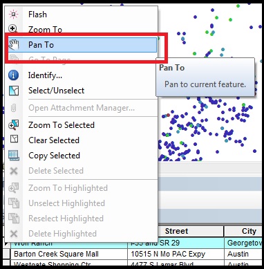
In some instances, after a scale range is added to a feature class while using the Pan To command from the attribute table to view a selected feature, the scale value changes. The Pan To command is used to shift a map image relative to the display window without changing the viewing scale. However, in this instance, the scale value is changed.
For example, a scale range is set to a feature class with the 'Do not show layer when zoomed: out beyond: 1:5000 (minimum scale)' option. After zooming in at a scale of 1:1000, the attribute table for the feature class is opened, and the Pan To command is used to view the feature in ArcMap. However, the scale is switched from 1:1000 to 1:5000.
Cause
This is a known limitation until ArcMap 10.5. Refer to the following defect, Bug NIM048700. The issue may occur when larger (closer) visible scales are set on the data.
Solution or Workaround
Use the following solution to workaround this issue.Disable the option for the visibility scale range setting in the feature properties
Note:
This workflow may be repeated if there are several features or layers in a map.
- Right-click the selected layer or feature, and select Properties.
- In the Layer Properties window, click the General tab.
- Under Scale Range, click Show layer at all scales to disable the option for the visibility scale range.
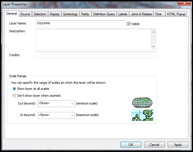
- Click OK. The feature selections in the attribute table can be panned without changing the scale value.
Article ID:000012406
- ArcMap 10 x
Get help from ArcGIS experts
Download the Esri Support App
Related Information
Discover more on this topic
Search for related information
Find training related to this topic
Explore ideas and give feedback