HOW TO
Set a custom scale range for a tile service in ArcGIS Online
Summary
A default ArcGIS Online basemap has a set limitation; it is not possible to zoom in further than the scale of 1:1128. To zoom in further than the default scale range, a tiled map service package with a custom scale range can be created in ArcMap, published to ArcGIS Online, and used as a basemap.
The instructions provided describe how to publish a tiled map service with desired sets of scale (custom scale).
Procedure
Note:
An organizational account with privileges to publish hosted tiles is needed for the following procedure.
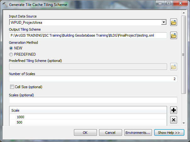
- In ArcMap, navigate to ArcToolbox > Data Management Tools > Tile Cache, and run the Generate Tile Cache Tiling Scheme tool. Fill out the following parameters to define the tiling scale and number.
- Input Data Source: The map document file.
- Output Tiling Scheme: The output path for the tiling scheme.
- Number of Scales: The desired number of scale levels in the tiling scheme.
- Scales: The scale levels to be included in the tiling scheme. The value entered in the Number of Scales parameter generates a set of default scale levels.
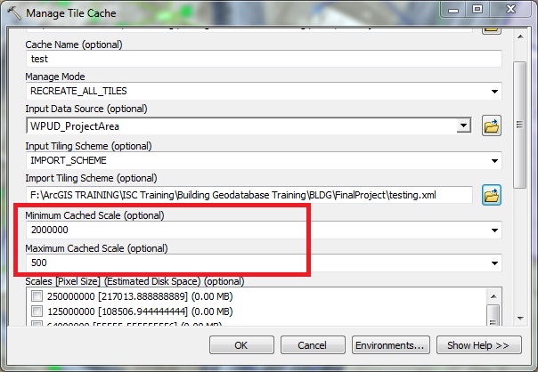
- Run the Manage Tile Cache tool and fill out the following parameters to build the tiles.
- Cache Location: A folder location to save the cache.
- Cache Name: Name of the cache.
- Input Data Source: The map document.
- Input Tiling Scheme: Select IMPORT_SCHEME.
- Import Tiling Scheme: Add the XML file created in Step 1.
- Set the minimum and maximum cached scale with the desired scales.
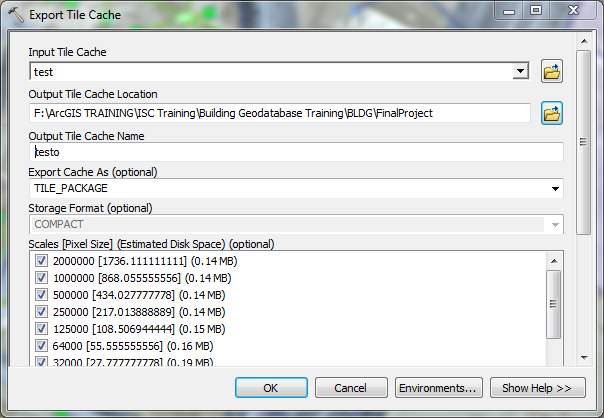
- Run the Export Tile Cache tool and fill out the following parameters to create the tile package.
- Input Tile Cache: The tile cache created from Step 2.
- Output Tile Cache Location: Any folder to save the tile package (.tpk).
- Export Cache As: TILE_PACKAGE
- Run the Share Package tool to upload the tiles to ArcGIS Online.
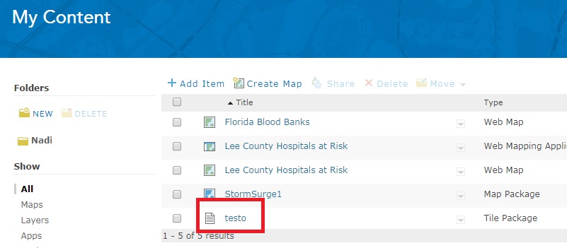
- Publish the tile package from ArcGIS Online. This creates a tiled map service.
- Once the tile package is uploaded and published successfully, copy the URL of the tiled map service to add it as a basemap in the ArcGIS Online map viewer. This gives the ability to zoom in to the desired scale level set earlier. Refer to the following blog post, Using custom basemaps, for more information.
Article ID: 000012213
- ArcMap
- ArcGIS Online
Get support with AI
Resolve your issue quickly with the Esri Support AI Chatbot.


Related Information
Discover more on this topic
Search for related information
Find training related to this topic
Explore ideas and give feedback
Get help from ArcGIS experts
Start chatting now