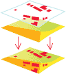
union
-
[analysis/geoprocessing]
The overlay of two or more spatial polygon datasets that preserves the features that fall within the spatial extent of either input dataset. In a union, all features from both datasets are retained and extracted into a new polygon dataset.