PROBLEM
3D multipatch feature is drawn incorrectly when published to ArcGIS Online
Description
Sometimes, a multipatch feature published from ArcGIS Pro does not display correctly in ArcGIS Online. For example, a feature is created on the ground in ArcGIS Pro; however, when exported to ArcGIS Online, the feature floats above the ground.
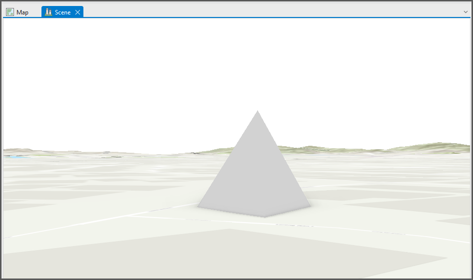
The image below shows the multipatch feature created in ArcGIS Pro.
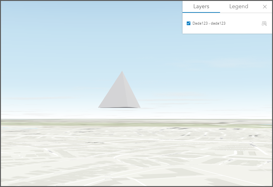
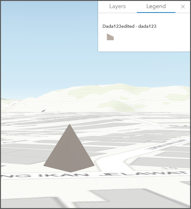
The image below shows the multipatch feature after exporting to ArcGIS Online.
Cause
When a multipatch feature is published from ArcGIS Pro to ArcGIS Online, the following warning message is returned:
Warning: Ellipsoidal vertical coordinate systems may draw incorrectly
This is an expected behavior when an unsupported Z coordinate system is used to create the feature. Subsequently, publishing the multipatch feature to ArcGIS Online with an unsupported Z coordinate system causes the feature to display incorrectly.
Solution or Workaround
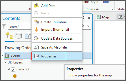
Change the coordinate system of the scene in ArcGIS Pro before publishing to ArcGIS Online
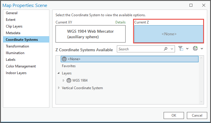
- In ArcGIS Pro, right-click the scene layer in the Contents pane and select Properties.
- In the Map Properties: <scene name> pane, click Coordinate Systems.
- Click Current Z.
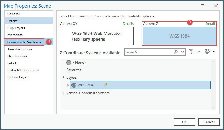
- Under Z Coordinate Systems Available, change the coordinate system to <None> or to a supported coordinate system. There are two supported vertical coordinate systems: ellipsoidal and gravity-based system, for example, EGM2008 or EGM1996.
- Share the feature as a web layer. Refer to ArcGIS Pro: Share a web feature layer for more information.
Modify the offset value in ArcGIS Online
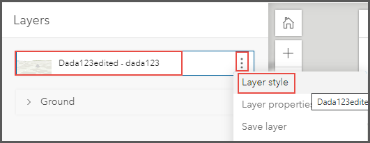
- In ArcGIS Online, under My Content, open the imported scene layer in Scene Viewer. In this example, the layer name 'dada123edited' is used.
- Under Layers, click the ellipsis icon on the layer and select Layer style.
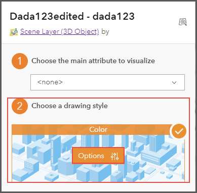
- In the <Layer name> pane, under Choose a drawing style, click Options.
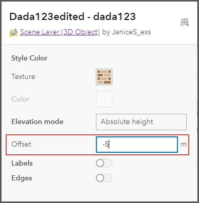
- For Offset, enter a positive or negative value in meters to offset the layer higher or lower. Click Done.
The image below shows the multipatch feature display correctly on the ground.
Article ID:000028982
- ArcGIS Online
- ArcGIS Pro 3 0
- ArcGIS Pro 2 x
Get help from ArcGIS experts
Download the Esri Support App
Related Information
Discover more on this topic
Search for related information
Find training related to this topic
Explore ideas and give feedback