PROBLEM
Some raster images created using the Create Mosaic Dataset tool are not displayed in ArcMap
Description
In ArcMap, when creating a mosaic dataset using the Create Mosaic Dataset tool and adding raster images to it using the Add Rasters To Mosaic Dataset tool, some rasters images in the mosaic dataset are not displayed on the map.
Cause
This problem occurs because there are mixed resolutions in the mosaic dataset. If the images in the mosaic dataset have different resolutions, the pixel size ranges in the MinPS or MaxPS columns are also different. This causes only images with the largest pixel size to be displayed on the map. For more information on MinPS and MaxPS, refer to ArcMap Help: Cell size ranges in a mosaic dataset.
Solution or Workaround
To resolve this issue, set the maximum number of images to reflect the total number of images in the mosaic dataset. Then, set the MaxPS field for all the images to the largest pixel size listed in the field.
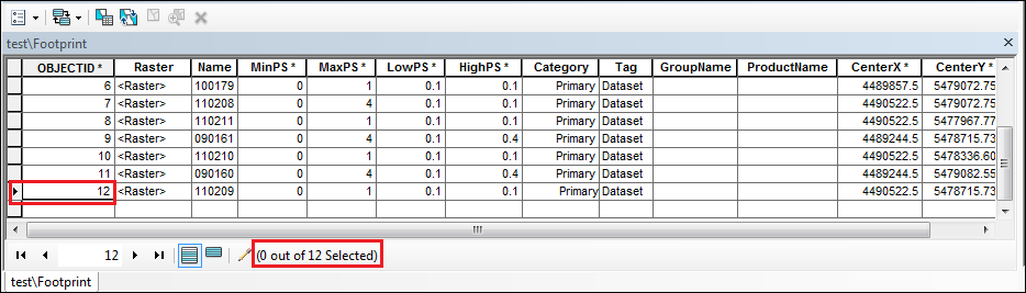
- In ArcMap, right-click the footprint layer in the Table of Contents and click Open Attribute Table to view the total number of images.
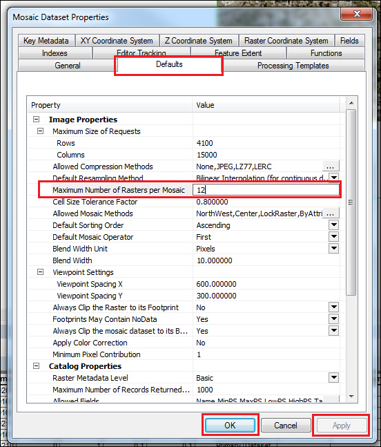
- In the Catalog pane, right-click the mosaic dataset and select Properties.
- In the Defaults tab, set the Maximum Number of Rasters per Mosaic to be the same as the total number of images. Click Apply > OK.
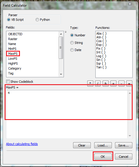
- In the attribute table, right-click the MaxPS field and select Field Calculator to set the MaxPS for all images to be the same as the largest MaxPS value listed in the field. Click OK.
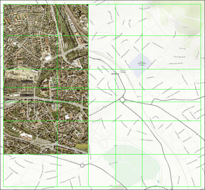
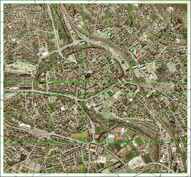
The image below shows all the raster images are displayed in the mosaic dataset after changing the maximum number of images and the pixel size in the MaxPS field.
Article ID: 000019948
- ArcMap
Get support with AI
Resolve your issue quickly with the Esri Support AI Chatbot.


Related Information
Discover more on this topic
Search for related information
Find training related to this topic
Explore ideas and give feedback
Get help from ArcGIS experts
Start chatting now