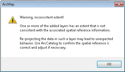
ERROR
One or more of the added layers has an extent that is not consistent with the associated spatial reference information
Error Message
When adding a feature class to a map document, the following inconsistent extent warning appears:
Error:
One or more of the added layers has an extent that is not consistent with the associated spatial reference information.

Re-projecting the data in such a layer may lead to unexpected behavior. Use ArcCatalog to confirm the spatial reference is correct and adjust if necessary.
Cause
This is caused by features in the dataset that fall outside the extent of the feature class.
This warning occurs if the coordinate system of the feature class is different from the coordinate system of the extent. For example, the feature geometry is stored in meters, but the projection is defined as a state plane coordinate system using feet or a geographic coordinate system using decimal degrees.
The error could also occur if new features were added after the original extent was set and the feature extent was not recalculated. For example, if the original dataset included cities in the U.S., and cities in Alaska or Hawaii were added without recalculating the feature extent.
Solution or Workaround
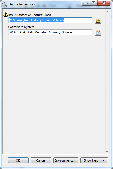
To change the coordinate system of the features, use the Define Projection tool to match the coordinate system of the feature class to the coordinate system of the current extent. Refer to ArcMap: Define Projection for more information.
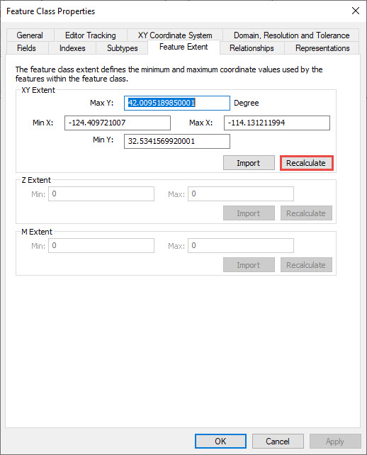
To recalculate the feature extent, right-click the feature from the Catalog window and click Properties.... Click the Recalculate button on the Feature Extent tab.
Article ID:000014348
- ArcMap
Get help from ArcGIS experts
Download the Esri Support App
Related Information
Discover more on this topic
Search for related information
Find training related to this topic
Explore ideas and give feedback