HOW TO
View polygon data from ArcGIS Pro in ArcGIS Earth as 3D features
Summary
ArcGIS Earth allows users to display data on the globe both in 2D or 3D, sketch place marks, measure distances and areas, and add annotations to understand spatial information. It is possible to view polygon data as 3D features such as buildings in ArcGIS Earth, provided the 2D polygon data have elevation values for extrusion. For 3D features, ArcGIS Earth supports KML and KMZ files.
Procedure
The instructions provided describe how to view the polygon data from ArcGIS Pro in ArcGIS Earth as 3D features.
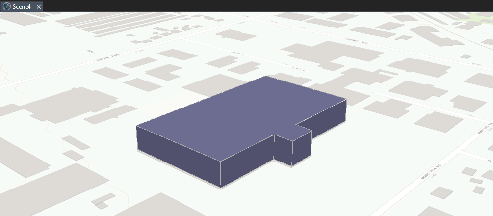
- In ArcGIS Pro, open a new scene and add the polygon data to the map.
- Create 3D features from the polygon data by using the Feature To 3D By Attribute tool.
- Right-click the 3D polygon feature in the Contents pane > Properties.
- In the Layer Properties window, click Elevation > set the features as On the ground, and click OK.
- Extrude the polygon feature.
- Select the polygon layer in the Table of Contents.
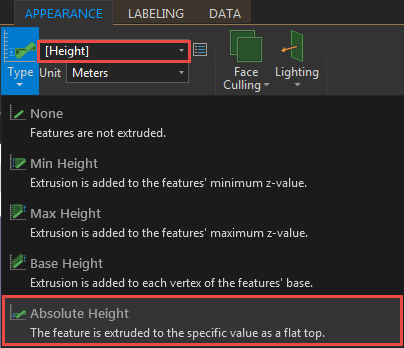
- Click the Appearance tab on the ribbon.
- In the Extrusion group, click the Type drop-down arrow and select Absolute Height.
- Select the field containing the elevation values from the drop-down menu.
- Convert the layer into a KML file by using the Layer To KML tool.
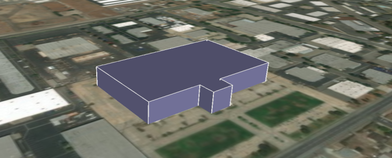
- In ArcGIS Earth, click the Add Data button on the toolbar and open the KML file.
Article ID: 000012939
- ArcGIS Earth
- ArcGIS Pro
Get support with AI
Resolve your issue quickly with the Esri Support AI Chatbot.


Related Information
Discover more on this topic
Search for related information
Find training related to this topic
Explore ideas and give feedback
Get help from ArcGIS experts
Start chatting now