PROBLEM
Unable to package offline areas for tile layers in Field Maps Designer and from Item Details page in ArcGIS Online
Description
When attempting to generate an offline area for a tile layer, the offline area fails to package with a generic "Failed" message in Field Maps Designer and from the Item Details page in ArcGIS Online. The same offline area will successfully package on the tile layer if the offline area is created from the Field Maps mobile device.
When checking the packaging requests from REST, REST indicates that the packaging job was successful despite the error message and failure to create the area.
Cause
The tile layer was published with an extent range smaller than what is being defined as the extent for the offline area. If the tile layer created is not set to the range of extent used for the layer in offline mode during the publishing to ArcGIS Online process, the offline area packaging fails.
Solution or Workaround
When publishing the tile layer from ArcGIS Pro to ArcGIS Online, have the users publish their service specifying the Level of Detail to be the same as what will be used when creating the offline area. An example workflow is as follows:
- In ArcGIS Pro, have the project open.
- Select Share > Publish as Web Layer from the tabs along the top.
- In the Share as a Web Layer pane, navigate to the Configuration tab.
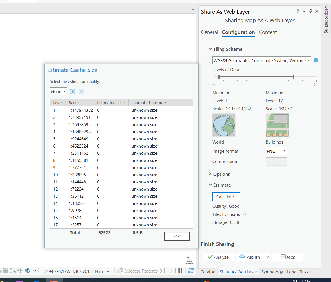
- Change the minimum and maximum Levels of Detail to the ranges needed, as shown in the following image.
Note:
The min/max number depends on the size of the data. The larger the dataset, the more credits it uses for increased min and max. Tile Generation costs one credit per 1,000 Tiles Generated. You can estimate the credits used prior to publishing from ArcGIS Pro to ArcGIS Online using the Estimate > Calculate options in the same configuration window, as shown in the next image.
- Republish this layer to ArcGIS Online.
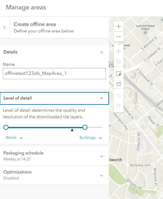
- Create the offline area, using the same Level of Detail configured when publishing from ArcGIS Pro, as shown in the image below.
Article ID: 000031661
- ArcGIS Online
Get support with AI
Resolve your issue quickly with the Esri Support AI Chatbot.


Related Information
Discover more on this topic
Search for related information
Find training related to this topic
Explore ideas and give feedback
Get help from ArcGIS experts
Start chatting now