PROBLEM
Z-values not preserved when snapping vertices to a geometry in ArcGIS Pro
Description
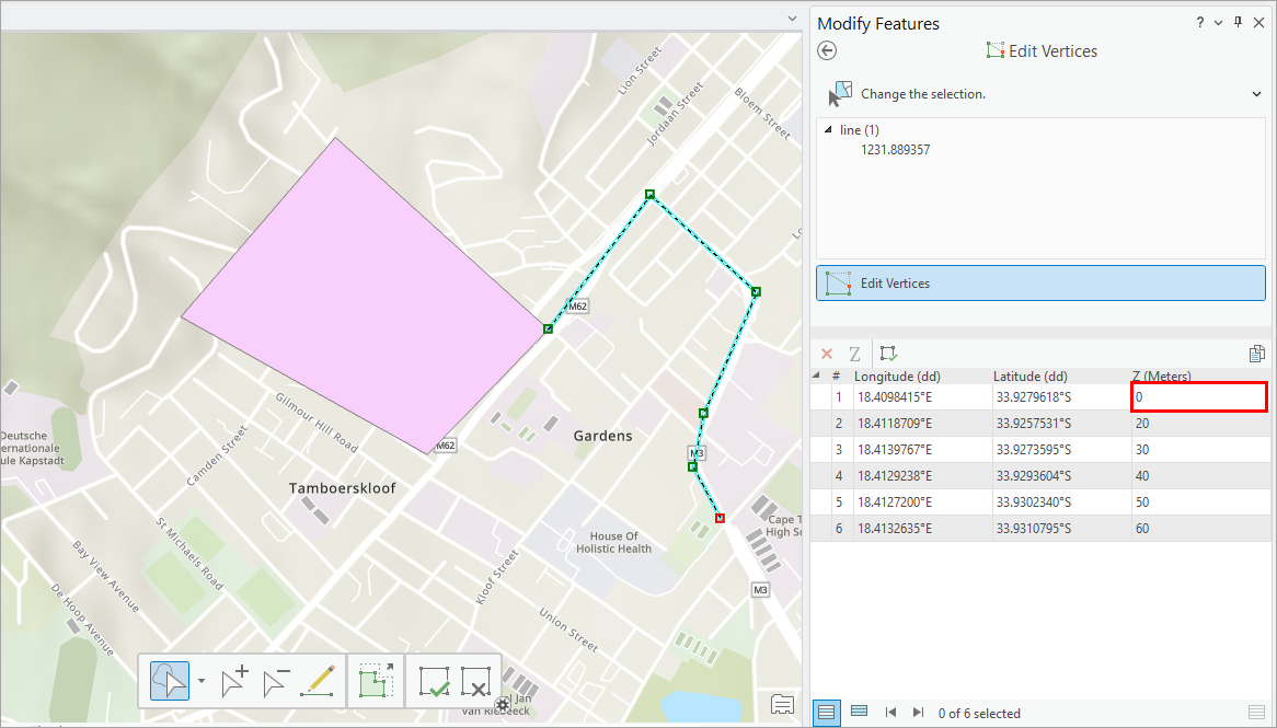
When snapping a vertex to a geometry in ArcGIS Pro, the z-value of the vertex is not preserved, instead, it inherits the z-value of the target geometry it is snapped to. This behavior can affect workflows that rely on accurate 3D data, such as terrain modeling and engineering design, by introducing unintended elevation changes that compromise data integrity and lead to errors in elevation analysis.
The image below shows an example of the z-value of a line feature that changes to zero (0) after a vertex is snapped to a polygon because the polygon’s z-values are set to zero (0).
Cause
This is expected behavior when snapping is performed in a 2D map with Z Snap enabled. When snapping occurs, the z-value of the vertex is updated to match the z-value of the geometry it is snapped to. In a 2D map, although elevation is not visually represented, z-enabled features still retain and update z-values during editing.
Solution or Workaround
To resolve this issue, disable Z Snap in Editor Settings.
- Open the project in ArcGIS Pro.
- On the ribbon, click the Edit tab.
- On the Edit tab, in the Manage Edits group, click Settings
 .
. - In the Editor Settings dialog box, on the Snapping tab, under General, uncheck the Z Snap checkbox.
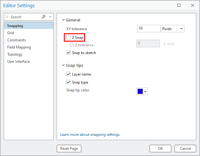
- Click OK.
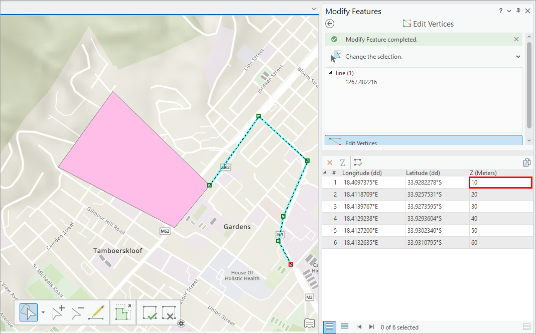
The image below shows the z-value of the line feature is preserved after snapping to the polygon when Z Snap is disabled.
Article ID: 000036250
- ArcGIS Pro
Get support with AI
Resolve your issue quickly with the Esri Support AI Chatbot.


Related Information
Discover more on this topic
Search for related information
Find training related to this topic
Explore ideas and give feedback
Get help from ArcGIS experts
Start chatting now