PROBLEM
Unable to draw parallel lines in a geographic coordinate system in ArcGIS Pro
Description
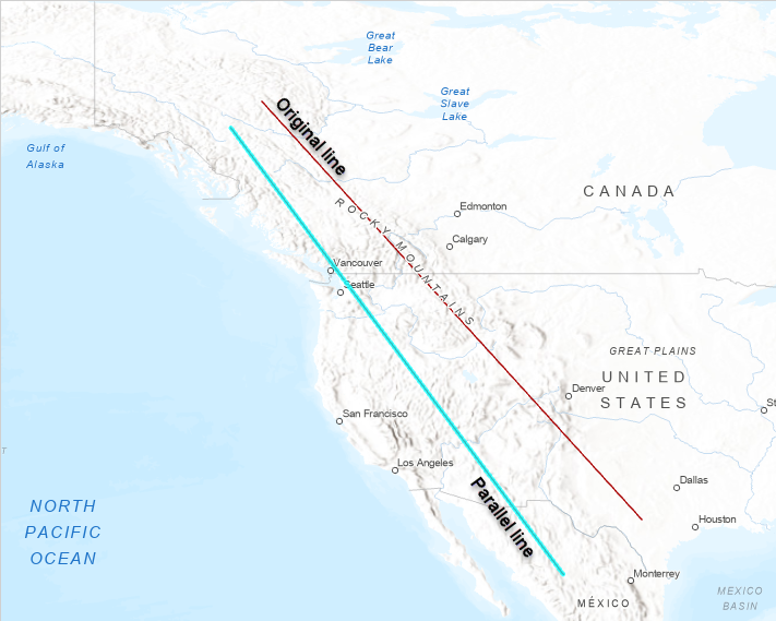
In ArcGIS Pro, when drawing a parallel line using the Parallel function on a dataset in a geographic coordinate system (GCS), the line drawn is not parallel to the original line. Instead, the line is drawn at a certain angle as shown in the image below.
Cause
This is expected behaviour. The parallel function does not work with a Geographic Coordinate System. This is because the parallel lines are drawn onto a 3D surface in a GCS which follows the curvature of the earth.
Solution or Workaround
To resolve this issue, use a projected coordinate system (PCS) for both the dataset and the map view where the map is projected onto a flat surface. To do so, use the Project tool. Refer to ArcGIS Pro: Project for more information.
The image below shows the parallel line created when using a projected coordinate system.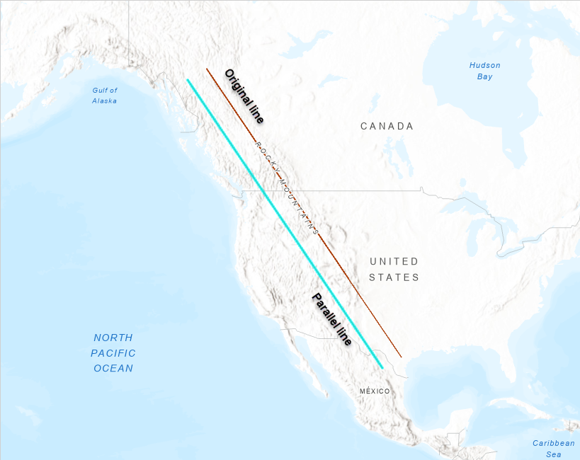
Note:
If the lines are drawn in 3D scene, which by default is in a GCS, the line becomes curved as it respects the curvature of the earth.
Article ID: 000022066
- ArcGIS Pro 2 x
Get support with AI
Resolve your issue quickly with the Esri Support AI Chatbot.


Related Information
Discover more on this topic
Search for related information
Find training related to this topic
Explore ideas and give feedback
Get help from ArcGIS experts
Start chatting now