PROBLEM
Unable to download ground control points attachments in Drone2Map for ArcGIS
Description
In some instances, when importing ground control points (GCPs) containing attachments using the Import from File Geodatabase option, the attachments fail to download to the folder (GCP Photos) in the project directory.
Cause
This issue occurs if the Global ID field is missing from the GCPs feature class in the file geodatabase. The Global ID field is required for the attribute table to participate in geodatabase replication and to uniquely identify a feature or table row within a geodatabase and across geodatabases.
Solution or Workaround
Create a point feature class containing a Global ID field in ArcGIS Pro, and add the GCPs and attachments to the feature class. Use the point feature class when importing GCPs in the Drone2Map for ArcGIS application.
- In ArcGIS Pro, create a new file geodatabase.
- Create a point feature class in the file geodatabase created in Step 1. Right-click the file geodatabase in the Catalog pane, select New, and click Feature Class to open the Create Feature Class pane.
- In the Define section, fill in all the required fields and click Next.
- For Name, type the output name for the point feature class.
- For Feature Class Type, select Point.
- For Geometric Properties, uncheck both M Values and Z Values.
- In the Fields section, add two new fields, and click Next.
- Field Name: Elevation, Data Type: Double
- Field Name: Label, Data Type: Text
- In the Spatial Reference section, select the coordinate system, and click Finish.
- In the Define section, fill in all the required fields and click Next.
- Edit the point feature class to add the GCPs using the Append tool.
- For Input Datasets, select the GCPs feature class.
- For Target Dataset, select the point feature class created in Step 2.
- For Schema Type, select Use the Field Map to reconcile schema differences.
- For Field Map, edit the source field for the Label and Elevation fields in the Source section.
- Select the Label field, click Add New Source, and select the field from the GCPs feature class that indicates the Label field or contains the attachment names.
- Select the Elevation field, click Add New Source, and select the field from the GCPs feature class that indicates the Altitude field or contains elevation information.
- Click Run to execute the tool.
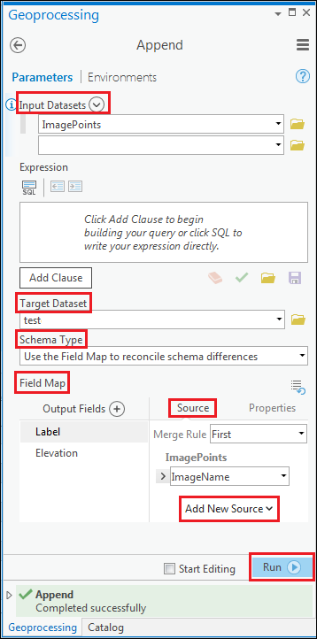
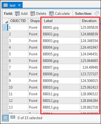
The point feature class is appended with the point features and attributes respective to the GCPs feature class.
- Create a Global ID field in the point feature class using the Add Global IDs tool. Select the point feature class as the input for the tool.
- Enable attachments for the point feature class using the Enable Attachments tool. Select the point feature class as the input for the tool.
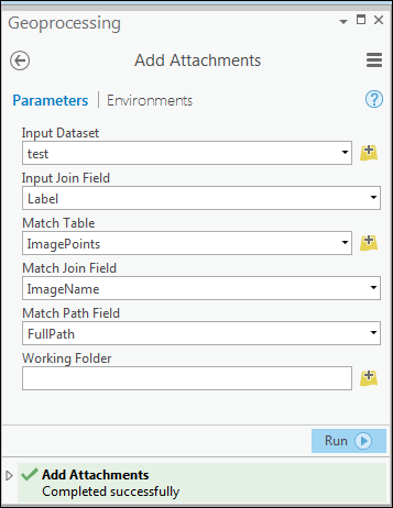
- Add the attachments from the GCPs feature class to the point feature class using the Add Attachments tool.
- In the Toolboxes window, navigate to Data Management Tools > Attachments > Add Attachments.
- For Input Datasets, select the point feature class created in Step 2.
- For Input Join Field, select Label.
- For Match Table, select the GCPs feature class.
- For Match Join Field, select the field from the GCPs feature class that indicates the Label field or contains the attachments names.
- For Match Path Field, select the field from the GCPs feature class that contains the attachments paths.
- Click Run to execute the tool.
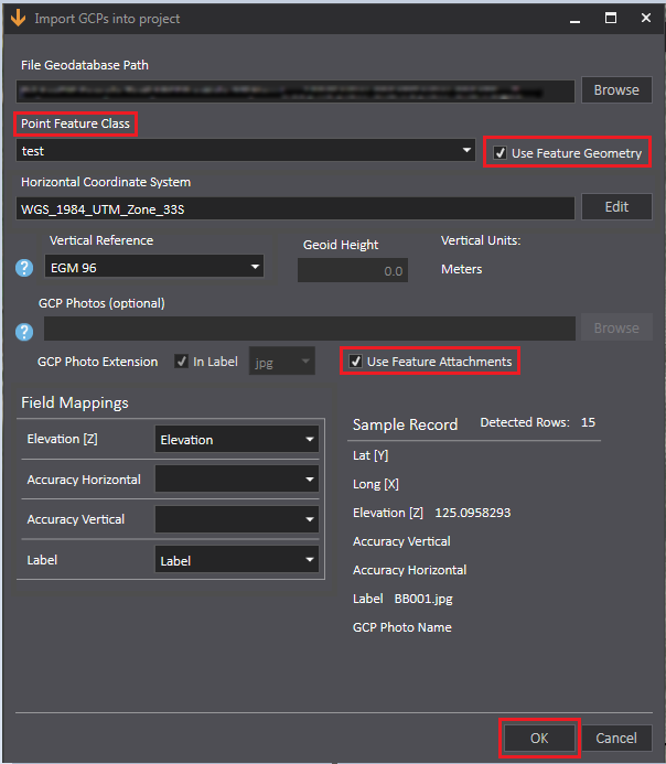
- When the attachments are successfully added to the point feature class, import the GCPs in the Drone2Map for ArcGIS application using the Import from File Geodatabase option. In the Point Feature Class section, select the point feature class created in the above steps. Check the Use Feature Geometry and Use Feature Attachments check boxes, and click OK.
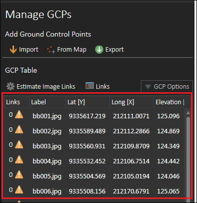
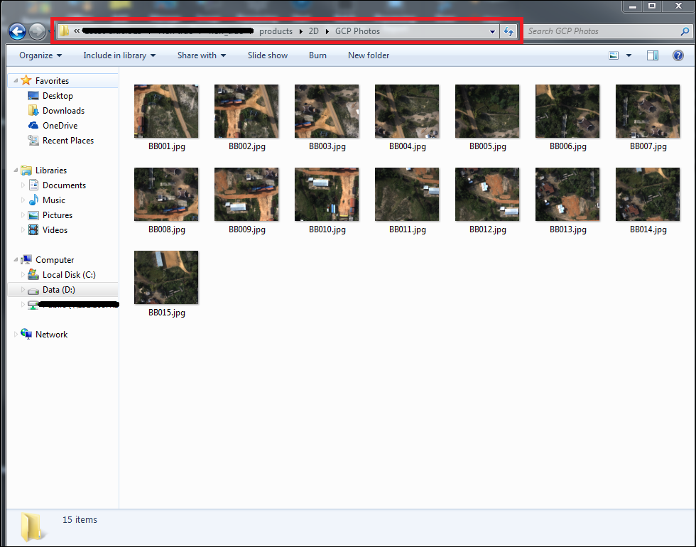
The following images show the GCPs added in the Manage GCPs dialog box, and the attachments downloaded to the project directory.
Article ID: 000018650
- ArcGIS Pro
- ArcGIS Drone2Map 1 x
Get support with AI
Resolve your issue quickly with the Esri Support AI Chatbot.


Related Information
Discover more on this topic
Search for related information
Find training related to this topic
Explore ideas and give feedback
Get help from ArcGIS experts
Start chatting now