PROBLEM
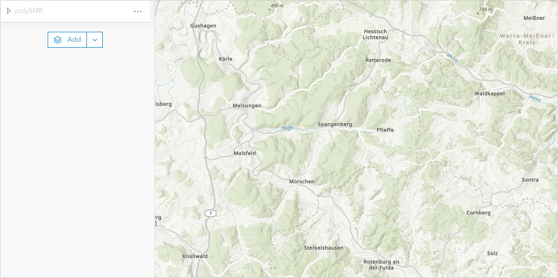
The tile layer is not visible in ArcGIS Online
Description
When opening a tile layer in ArcGIS Online Map Viewer, the tile layer is not visible on the map.
Cause
The level of detail (LOD) of the tile configuration is too low for the tile layer to be visible. The LOD represents the zoom level for a map view or scene view and displays various levels of details based on the configured LOD, where lower levels are furthest from the earth with smaller scales, while higher levels are closer to the earth with larger scales, and can zoom in to the extent of streets, buildings, and houses.
Solution or Workaround
- Start ArcGIS Pro.
- In the Contents pane, right-click the layer and click Sharing > Share As Web Layer.
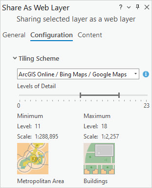
- In the Share As Web Layer pane, click the General tab.
- For Layer Type, select Tile.
- Click the Configuration tab.
- For Levels of Detail, use the sliders to set the appropriate map scales for which tiles are generated. In this example, Level 11 (Metropolitan Area) and Level 18 (Buildings) are set.
- Share the web layer. Refer to ArcGIS Pro: Share a web tile layer using the default configuration for further instructions.
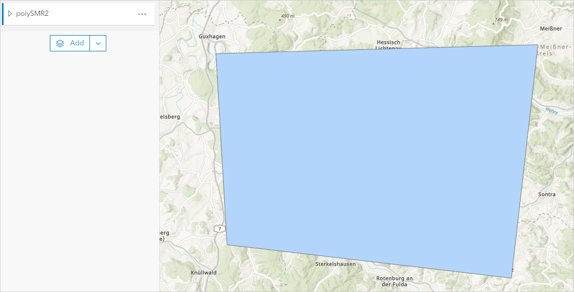
The image below shows the tile layer is now visible in ArcGIS Online Map Viewer.
Article ID: 000031377
- ArcGIS Online
- ArcGIS Pro 3 1
- ArcGIS Pro 3 0
- ArcGIS Pro 3 2
Get support with AI
Resolve your issue quickly with the Esri Support AI Chatbot.


Related Information
Discover more on this topic
Search for related information
Find training related to this topic
Explore ideas and give feedback
Get help from ArcGIS experts
Start chatting now