PROBLEM
The Measure tool in ArcMap and ArcGIS Online displays different measurement values
Description
The Measure tool is used to measure distances or areas in ArcMap and ArcGIS Online. However, when measuring areas in ArcMap and ArcGIS Online, the Measure tool displays different measurement values. Refer to ArcMap: Measuring distances and areas and ArcGIS Online: Measure (Map Viewer Classic) for more information on the tool in ArcMap and ArcGIS Online.
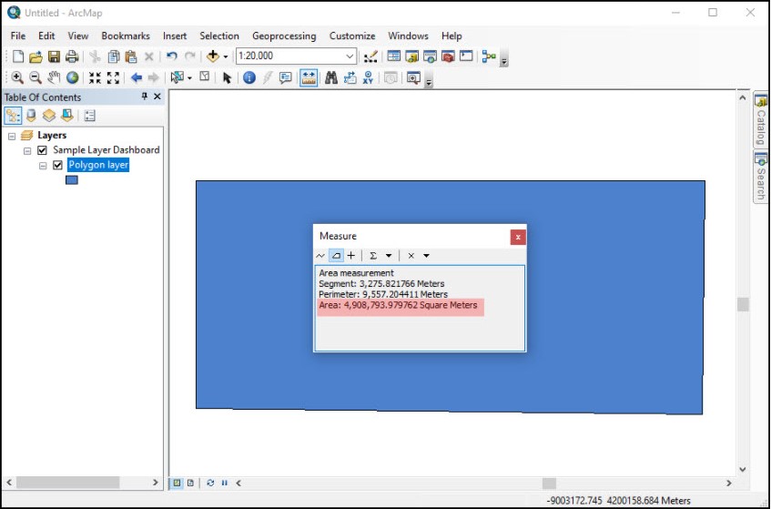
The following image displays the Measure tools's measurement value for a polygon area in ArcMap.
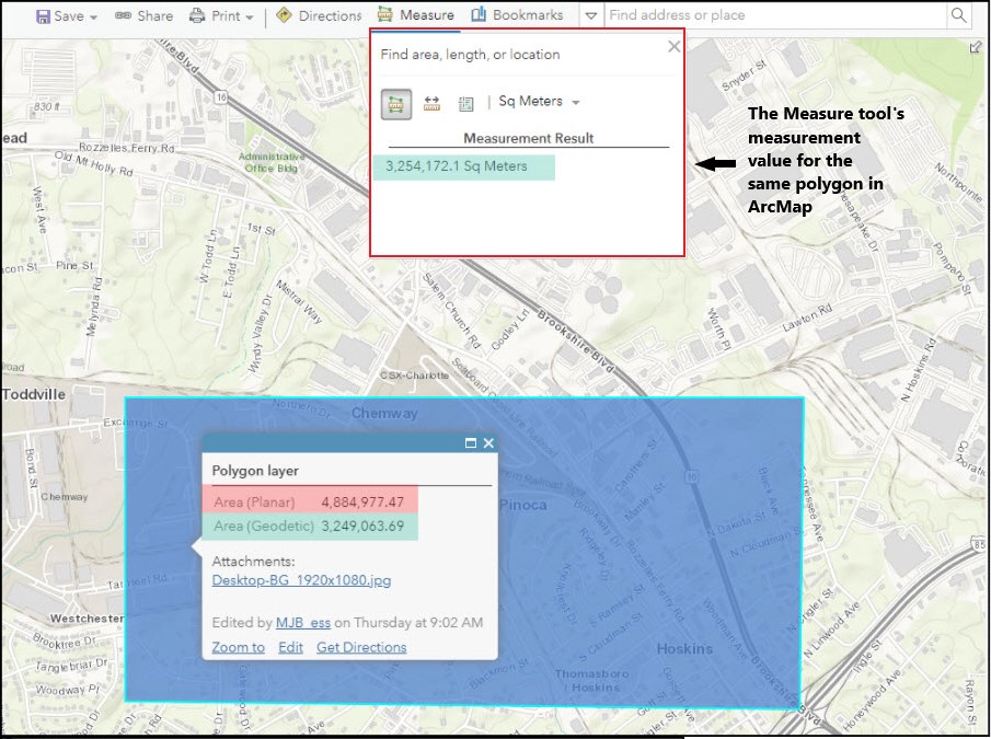
The following image displays the Measure tool's measurement value for the same polygon area in ArcGIS Online.
Cause
The Measure tool in ArcGIS Online Map Viewer uses the Geodesic measurement method. However, the Measure tool in ArcMap uses the Planar measurement method as the default when working in a projected coordinate system, and Geodesic is the default measurement when working in a geographic coordinate system.
Although Planar is the area measurement in ArcMap, the measurement results differ for different coordinate systems. The layer's coordinate system is defined by the data frame's coordinate system. Refer to How To: Check the coordinate systems of the data frame and layers in ArcMap for more information.
Note:
When starting ArcMap with a new, empty map, the coordinate system for the default data frame is not defined. The first added layer to an empty data frame sets the coordinate system for the data frame, but it can be changed if necessary. As subsequent layers are added, they are automatically displayed using the data frame's coordinate system as long as the data source's coordinate system is defined. Refer to ArcMap: Specifying a coordinate system for more information.
Solution or Workaround
To calculate an area in the Planar or Geodetic measurement in ArcGIS Online, use the Area or AreaGeodetic function in Arcade expressions.
- Open the feature layer's attribute table in ArcGIS Online Map Viewer Classic.
- Add a Double field to the attribute table. Refer to ArcGIS Online: Add a field for steps to do so.
- Populate the new field with by calculating the area using the Area or AreaGeodetic function in an Arcade expression.
- Click the new field header, and select Calculate. In the Calculate Field window, select Arcade.
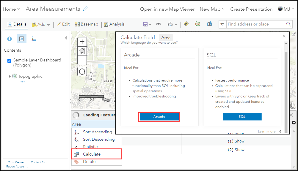
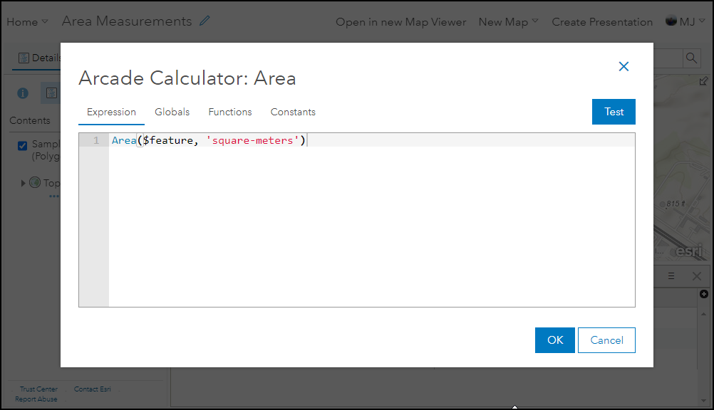
- Fill in the Arcade Calculator dialog box with the following Arcade expression to calculate area using the Planar or Geodetic method respectively:
Area($feature, 'square-meters')
AreaGeodetic($feature, 'square-meters')
- Click OK.
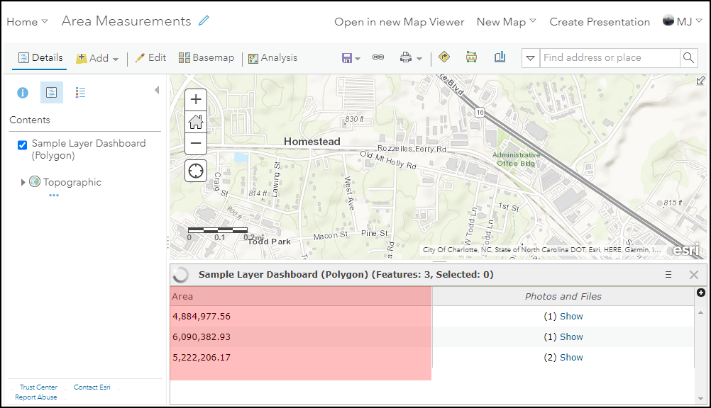
The following image displays the values of the calculated area using the Planar method populated in the Area field.
Note:
Alternatively, calculate the area using the Area and AreaGeodetic functions for the Planar and Geodetic method in the web map's Attribute Expressions pop-up configuration. Refer to ArcGIS Online: Use attribute expressions for more information.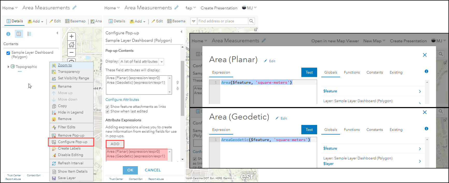
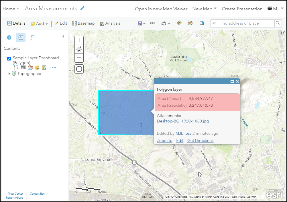
The following image displays the values of the calculated area using the Planar and Geodetic method populated in the web map's pop-up.
Article ID: 000025805
- ArcGIS Online
- ArcMap 10 6
- ArcMap 10 x
- ArcMap 10 7
- ArcMap 10 8
Get support with AI
Resolve your issue quickly with the Esri Support AI Chatbot.


Related Information
Discover more on this topic
Search for related information
Find training related to this topic
Explore ideas and give feedback
Get help from ArcGIS experts
Start chatting now