PROBLEM
The linear units of measurement are unavailable with offset tracing in ArcGIS Pro
Description
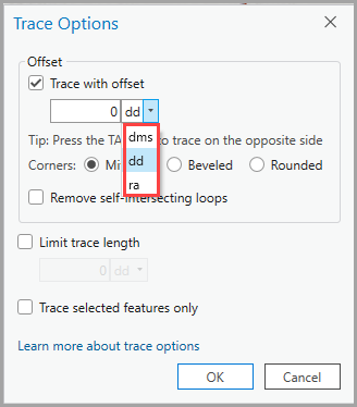
In ArcGIS Pro, when the ‘Trace with offset’ check box is checked in the Trace Options dialog box, the Units drop-down menu displays angular units, such as Decimal Degrees (DD), Degrees Minutes Seconds (DMS), and Right Ascension (RA) as options, instead of linear units, such as mile (mi), feet (ft), US feet (ftUS), yard (yd), kilometer (km), and meter (m).
Cause
The map in the ArcGIS Pro project uses the geographic coordinate system. A geographic coordinate system records locations in angular units. Refer to ArcGIS Pro: Coordinate systems, map projections, and transformations for more information.
Solution or Workaround
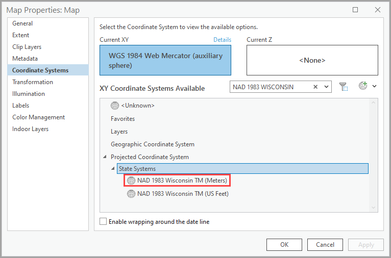
Change the map's coordinate system to a projected one. Refer to ArcGIS Pro: Set the coordinate system for instructions. In this example, the coordinate system is changed to 'NAD 1983 Wisconsin TM (Meters)'.
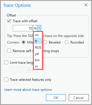
The image below shows the menu displaying linear unit options after changing the map's coordinate system to a projected one.
Article ID: 000033455
- ArcGIS Pro 3 3
- ArcGIS Pro 3 2
- ArcGIS Pro 3 4
Get support with AI
Resolve your issue quickly with the Esri Support AI Chatbot.


Related Information
Discover more on this topic
Search for related information
Find training related to this topic
Explore ideas and give feedback
Get help from ArcGIS experts
Start chatting now