PROBLEM
The Image Service cell size does not match the source mosaic dataset
Description
After publishing a mosaic dataset as a Cached Image Service from ArcMap, the Image Service cell size differs from the cell size of the source mosaic dataset.
Cause
The cell size for a Cached Image Service is determined by the Tiling Scheme used when publishing the service. Each zoom level in the Tiling Scheme has a predefined cell size. When viewing the cell size property of the Image Service through ArcMap or ArcCatalog, the size of the largest scale of the tiling scheme is listed. For example, if the ArcGIS Online/Bing Maps/Google Maps tiling scheme is used, the cell size of the largest scale may be 0.298582, which corresponds to the scale at level 19. Within each scale level, a different cell size is used. This can be seen when publishing in the Service Editor properties under the Caching tab.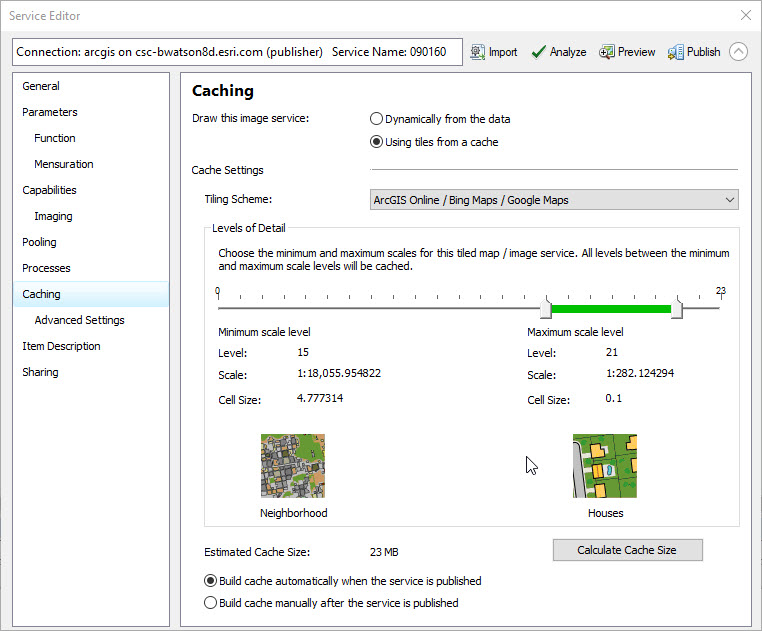
Solution or Workaround
Use one of the following solutions to resolve the issue:
- To reduce or set the cell size (pixel size or resolution), create a custom tiling scheme by referring to: Generate Tile Cache Tiling Scheme. Use the custom tiling scheme when publishing the Image Service.
- Publish the mosaic dataset as a dynamic image service, where the cell size matches the mosaic dataset cell size.
Article ID: 000018666
- ArcGIS Online
Get support with AI
Resolve your issue quickly with the Esri Support AI Chatbot.


Related Information
Discover more on this topic
Search for related information
Find training related to this topic
Explore ideas and give feedback
Get help from ArcGIS experts
Start chatting now