PROBLEM
The GeoTagged Photos To Points tool generates an empty output in ArcGIS Pro
Description
In ArcGIS Pro, running the GeoTagged Photos To Points tool generates an empty output, and in some instances, the following warning message is returned, "WARNING 000117: Warning empty output generated."
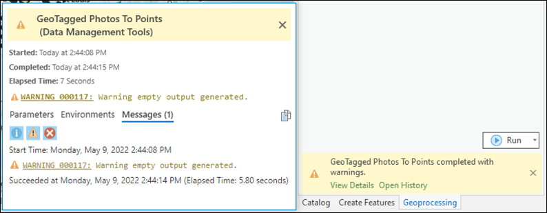
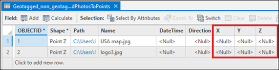
In a situation where the tool executes successfully, the output features do not contain any X, Y, or Z coordinate information and are not displayed on the map.
Cause
- The input geotagged photo file format such as HEIC or PNG is unsupported. The output layer’s attribute table is empty when the input geotagged photo file format is unsupported.
- The output features do not contain X, Y, or Z coordinate information when the photos in the input folder are not geotagged.
Solution or Workaround
Use supported geotagged photo file formats
Use supported geotagged photo file formats such as JPG or TIFF for the GeoTagged Photos To Points tool to generate the desired results.
Note:
In some instances, empty outputs are generated without any warning messages when the input folder is stored on a cloud storage, such as OneDrive. This is a known limitation. Refer to Problem: ArcGIS Pro and Cloud Storage Services for more information.
Article ID: 000027648
- ArcGIS Pro 2 8 x
- ArcGIS Pro 2 7 x
- ArcGIS Pro 2 x
Get support with AI
Resolve your issue quickly with the Esri Support AI Chatbot.


Related Information
Discover more on this topic
Search for related information
Find training related to this topic
Explore ideas and give feedback
Get help from ArcGIS experts
Start chatting now