PROBLEM
New shapefile features do not display in all extents in ArcGIS Pro
Description
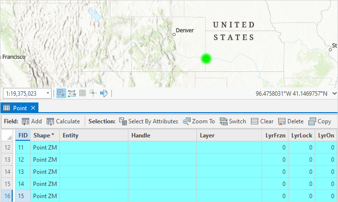
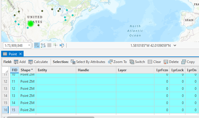
In ArcGIS Pro, when features are created in a shapefile, the features are displayed on the map and the attribute information is recorded in the attribute table. However, in some instances, the features do not display on the map when zooming in and only display when zooming out, as shown in the images below.
The features are not displayed when the map is zoomed in.
The features are not displayed when the map is zoomed out.
Cause
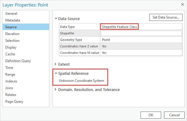
The coordinate system of the shapefile is an unknown coordinate system. Therefore, the newly created features do not have spatial references to be displayed in all extents.
Note:
To check the coordinate system of the shapefile, refer to the Tip section in ArcGIS Pro: Specify a coordinate system.
Solution or Workaround
In ArcGIS Pro, define the coordinate system of the shapefile using the Define Projection tool.
- Open the ArcGIS Pro project.
- In the Geoprocessing pane, search for the Define Projection tool. Refer to ArcGIS Pro: Run a tool in the Geoprocessing pane for instructions.
- In the Define Projection pane, under the Parameters tab, click the drop-down arrow under Input Dataset or Feature Class, and select the shapefile.
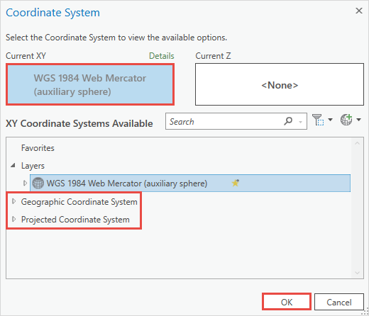
- For Coordinate System, click Select coordinate system
 to open the Coordinate System window.
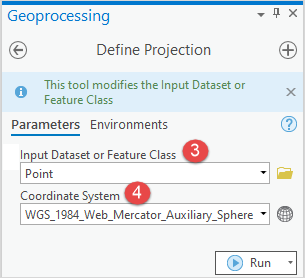
- In the Coordinate System window, expand Projected Coordinate System or Geographic Coordinate System to specify the coordinate system. In this example, WGS 1984 Web Mercator (auxiliary sphere) is selected. Click OK.
- In the Define Projection pane, click Run.
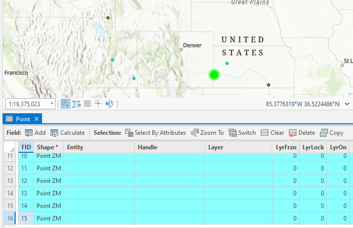
The image below demonstrates the newly created features displayed when the map is zoomed in.
Article ID: 000027718
- ArcGIS Pro 2 8 x
- ArcGIS Pro 2 7 x
- ArcGIS Pro 2 x
Get support with AI
Resolve your issue quickly with the Esri Support AI Chatbot.


Related Information
Discover more on this topic
Search for related information
Find training related to this topic
Explore ideas and give feedback
Get help from ArcGIS experts
Start chatting now