PROBLEM
Missing features after importing a KML file into ArcGIS Pro
Description
After importing a Keyhole Markup Language (KML) file into ArcGIS Pro, certain features are not displayed on the map, even though the features are present in the KML file. Missing features include points, lines, polygons, or other spatial data that are visible when viewed in Google Earth Pro or ArcGIS Online Map Viewer.
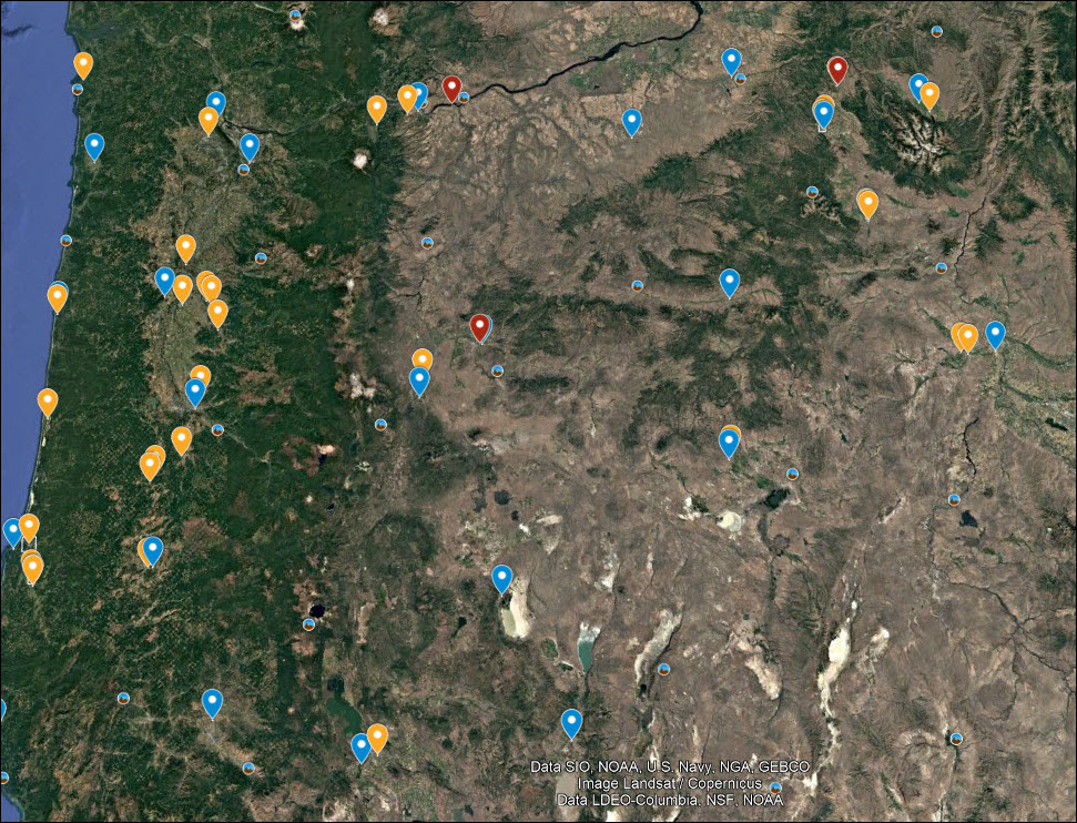
The map below shows the original features displayed after importing the KML file into Google Earth Pro.
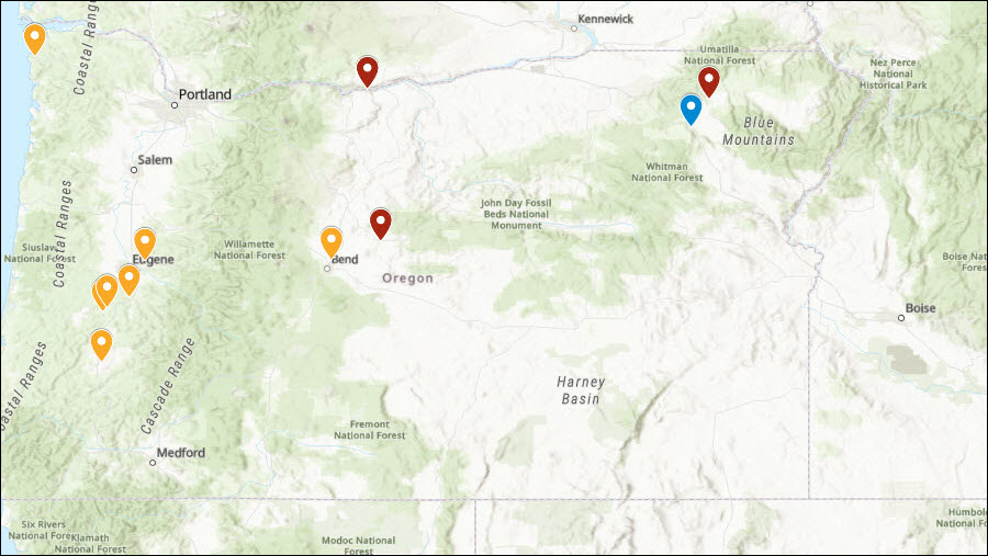
The map below shows only some features displayed after importing the KML file into ArcGIS Pro.
Cause
- The KML file has multipart features, for example, multiple disconnected geometries are represented as a single feature.
- The KML file contains features with a high number of vertices.
- The KML file is corrupted due to improper formatting, incomplete data, or errors introduced during creation or editing.
Solution or Workaround
Depending on the cause, the workarounds described below are applicable.
Use the Multipart To Singlepart tool in ArcGIS Pro
To separate the multipart features into singlepart features, use the Multipart To Singlepart tool in ArcGIS Pro.
- Open the ArcGIS Pro project.
- Navigate to the Analysis tab and click Tools.
- In the Geoprocessing pane, search for and select Multipart To Singlepart (Data Management Tools).
- Configure the parameters in the Multipart To Singlepart pane.
- For Input Features, select the feature layer from the drop-down menu.
- For Output Feature Class, specify a name and location for the output feature class.
- Click Run.
Use the Smooth Polygon tool in ArcGIS Pro
Note:
The Smooth Polygon tool is available with Standard and Advanced ArcGIS Pro licenses.
The Smooth Polygon tool reduces sharp angles in polygon outlines, improving visual appeal and cartographic accuracy.
- Open the ArcGIS Pro project.
- Navigate to the Analysis tab and click Tools.
- In the Geoprocessing pane, search for and select Smooth Polygon (Cartography Tools).
- Configure the parameters in the Smooth Polygon pane.
- For Input Features, select the feature layer from the drop-down menu.
- For Output Feature Class, specify a name and location for the output feature class.
- For Smoothing Tolerance, specify the preferred tolerance values from the drop-down menu. Refer to ArcGIS Pro: Parameters for more information.
- Click Run.
Re-export the KML file or export the layer as a KMZ file
Re-export the KML file as a new file using the original application used to generate the KML file.
Alternatively, export the layer as a KMZ file instead. KMZ is a compressed version of KML, reducing file size and making it more efficient to store, share, and manage large datasets. Its compression, bundling, and portability make KMZ a practical option for workflows in ArcGIS Pro, especially when working with complex datasets.
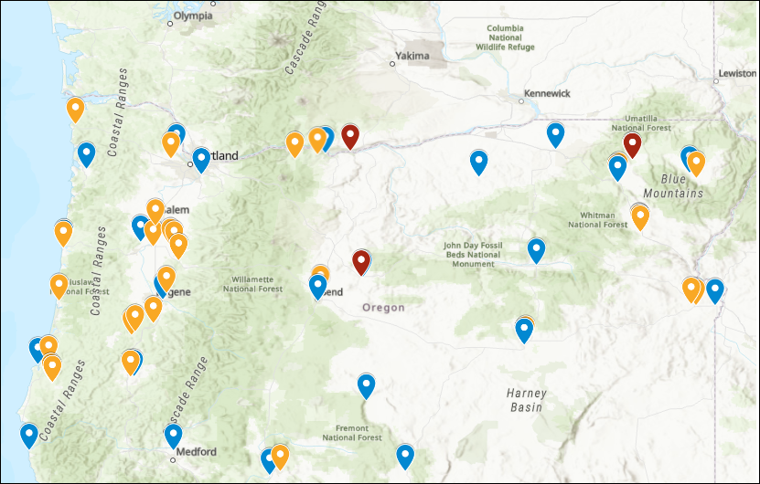
The map below shows the features correctly displayed after importing the KML file into ArcGIS Pro.
Article ID: 000034361
- ArcGIS Pro 3 3
- ArcGIS Pro 3 2
- ArcGIS Pro 3 4
Get support with AI
Resolve your issue quickly with the Esri Support AI Chatbot.


Related Information
Discover more on this topic
Search for related information
Find training related to this topic
Explore ideas and give feedback
Get help from ArcGIS experts
Start chatting now