PROBLEM
Labels for rasters with stretched symbology do not appear as expected when advanced labeling with more than two intervals is applied
Description
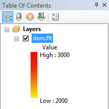
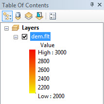
When rendering a raster using the Minimum-Maximum stretch type, and the Edit High/Low Values option is selected, the stretch values along the color ramp display only the highest and lowest values, even when more than two intervals are applied. The labels for interval values between the lowest and highest values for the raster do not appear.
Cause
This is a known limit. By default, the Edit High/Low Values option supports two labels (highest and lowest) when rendering a raster using the Minimum-Maximum stretch type.
Note:
When using the Minimum-Maximum stretch type, this issue also occurs if the raster display statistics is set to From Current Display Extent in the Statistics drop-down list, even if the Edit High/Low Values option is not selected.
Solution or Workaround
Follow the steps provided below as a workaround when using more than two intervals.
- Add the raster layer to the Table Of Contents.
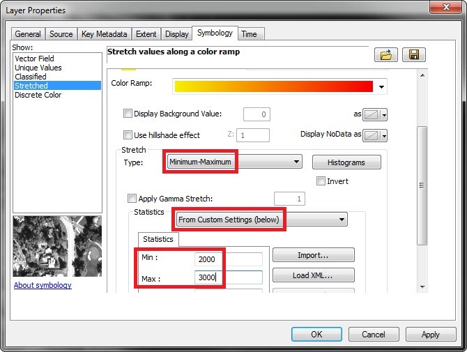
- In the Symbology tab of the raster layer properties, select a color ramp for the stretched symbology, and set the stretch type to Minimum-Maximum.
- Scroll down to the Statistics drop-down list, and select From Custom Settings (below).
- Insert the desired minimum and maximum values in the Min and Max fields respectively.
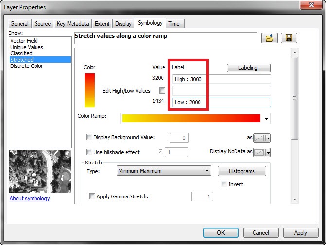
- Scroll back up, and change the label values according to the minimum and maximum values set in Step 3.
- Click Apply > OK to apply the changes and close the Layer Properties window.
- Right-click the layer in the Table Of Contents, and click Save As Layer File. Name the layer, and click Save to save the layer.
- In the Symbology tab of the original raster layer, click the Import icon
 to import the saved raster layer's symbology settings to the original raster layer.
 - Browse to the saved raster layer name, and click Add > OK.
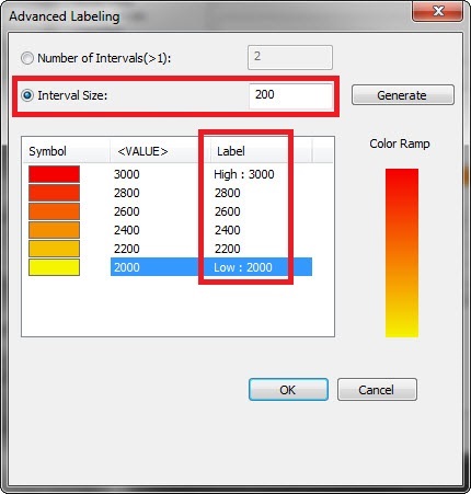
- Click the Labeling button to set the interval size and label names, and click OK.
- Click Apply > OK, and the raster labels appear as expected.
Note:
This issue does not occur in ArcGIS Desktop 10.5.
Article ID: 000014403
- ArcMap
Get support with AI
Resolve your issue quickly with the Esri Support AI Chatbot.


Related Information
Discover more on this topic
Search for related information
Find training related to this topic
Explore ideas and give feedback
Get help from ArcGIS experts
Start chatting now