PROBLEM
Label classes overlap at different zoom levels in the ArcGIS Experience Builder Map widget
Description
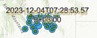
In the Map widget of ArcGIS Experience Builder, a label class may overlap another label class at different zoom levels, as shown in the image below. This may cause confusion in interpreting the map's geographic elements.
Cause
The visible range set for each label class when transitioning to different zoom levels does not have an interval.
Solution or Workaround
Set intervals in the visible range between label classes in ArcGIS Online Map Viewer.
- In Map Viewer, open the map containing the label classes. Refer to ArcGIS Online: Apply labels and follow Steps 1 through 8.
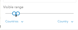
- Adjust the Visible range slider to change the visible range for the first label class. In this example, the zoom level is set from Countries to Country.
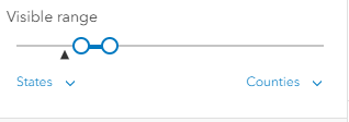
- Repeat Step 2 for the second label class. In this example, the zoom level is set from States to Counties.
- Click Save and open and click Save on the Contents (dark) toolbar to save the visible range setting of the map.
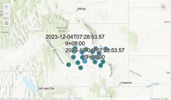
The image shows the label classes do not overlap in the Map widget in ArcGIS Experience Builder.
Note:
Reload and preview the experience in ArcGIS Experience Builder to apply the changes in the Map widget.
Article ID: 000031827
- ArcGIS Online
- ArcGIS Experience Builder
Get support with AI
Resolve your issue quickly with the Esri Support AI Chatbot.


Related Information
Discover more on this topic
Search for related information
Find training related to this topic
Explore ideas and give feedback
Get help from ArcGIS experts
Start chatting now