PROBLEM
KML files exported from ArcGIS Pro do not honor map extents when viewed in ArcGIS Earth
Description
When exporting a KML file using the Map To KML or Layer To KML tool in ArcGIS Pro, the process completes successfully, and the output can be opened and used in ArcGIS Earth. However, the displayed map extent in ArcGIS Earth does not match the specified extent from the tool in ArcGIS Pro. The KML file appears misaligned (either shifted, incorrectly centered, or excessively zoomed out), resulting in a misleading visual representation of the intended map area.
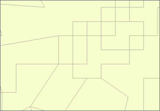
The image below shows the map extent in ArcGIS Pro.
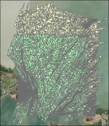
The image below shows the map extent of the KML file in ArcGIS Earth.
Cause
The Map To KML and Layer To KML tools do not honor the extent settings in ArcGIS Pro. This is a known issue, logged as a defect. Refer to BUG-000164274 and BUG-000166550 for more information.
Solution or Workaround
- Open the ArcGIS Pro project.
- Create a new polygon feature to be used as the mask extent in the following step. For instructions to create a polygon feature class, refer to ArcGIS Pro: Create a stand-alone feature class. Then, complete the steps to draw a desired polygon feature on the map, as described in ArcGIS Pro: Create polygon features.
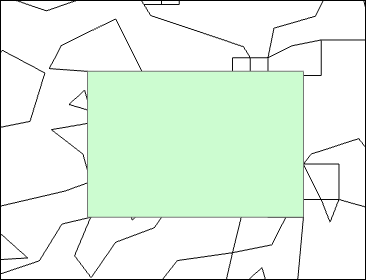
- Clip the original feature layer based on the mask extent using the Clip tool.
- On the Analysis tab, in the Geoprocessing group, click Tools.
- In the Geoprocessing pane, search for and click Clip.
- In the Clip pane, for Input Features or Dataset, select the feature layer to be clipped from the drop-down list.
- For Clip Features, select the polygon feature layer created in Step 2 from the drop-down list.
- For Output Features or Dataset, specify a name.
- Click Run.
Note:
Remove the original or any unnecessary layers to prevent exporting unwanted data before exporting the map. This can achieved by right-clicking the desired layer in the Contents pane and selecting Remove.
- Export the map or clipped layer to a KML file using the Map To KML or Layer To KML tool.
Note:
To download the latest version of ArcGIS Earth, refer to ArcGIS Earth: Download and install ArcGIS Earth for instructions.
- Open ArcGIS Earth and add the KML file created in Step 4. Refer to ArcGIS Earth: Local files for instructions and more information.
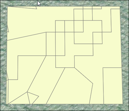
The image below illustrates the correct map extent in ArcGIS Earth.
Article ID: 000036680
- ArcGIS Earth
- ArcGIS Pro
Get support with AI
Resolve your issue quickly with the Esri Support AI Chatbot.


Related Information
Discover more on this topic
Search for related information
Find training related to this topic
Explore ideas and give feedback
Get help from ArcGIS experts
Start chatting now