PROBLEM
Images with the same projection do not overlap in ArcMap
Description
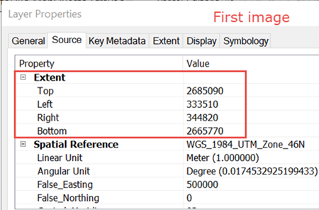
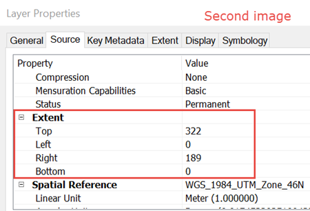
In some instances, raster images with the same projection do not overlap in ArcMap.
Cause
This issue may occur if one or more of the raster images have different extents.
Solution or Workaround
Check which raster image has the wrong extent and georeference the image. For more information, refer to How To: Georeference an image to align with other data.
Article ID: 000018120
Software:
- ArcMap
Get support with AI
Resolve your issue quickly with the Esri Support AI Chatbot.


Related Information
Discover more on this topic
Search for related information
Find training related to this topic
Explore ideas and give feedback
Get help from ArcGIS experts
Start chatting now