PROBLEM
Gaps are displayed on the 3D layer in ArcGIS Pro
Description
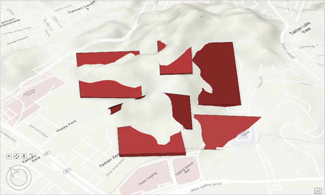
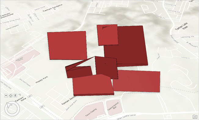
The 3D multipatch features display gaps or holes in a scene. This behavior is reproducible in both local and global scenes.
This article provides two workarounds.
Cause
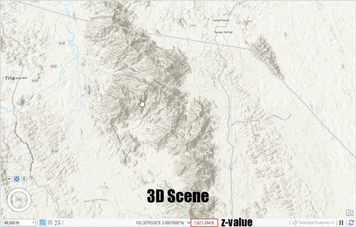
The surface of the multipatch feature is lower than the elevation of the surface layer, causing the surface to display gaps in the scene. This is expected behavior. Unlike a 2D map, the ground elevation surface in a scene contains z-coordinates that can be observed by hovering the cursor over the different surfaces and identifying the third value from the bottom of the window. The third value represents the height relative to the flat plane, and when the height of the surface is higher than the z-value of the feature, the ground surface elevation is overlaid with the feature.
Solution or Workaround
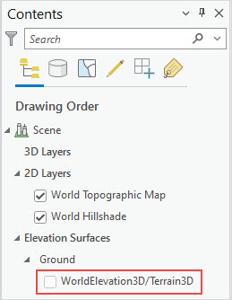
Disable the ground elevation surface layer
Uncheck the ground layer check box in the Contents pane. Refer to ArcGIS Pro: Turn editability off for a layer for more information.
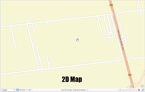
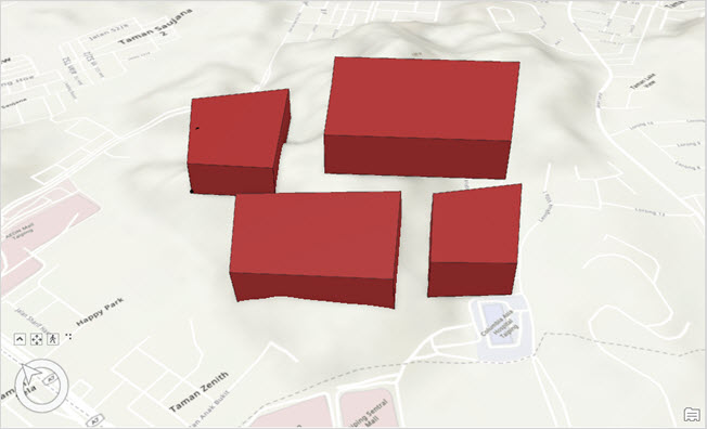
The map below shows the 3D multipatch features displayed with no holes and gaps.
Increase the depth of the 3D multipatch feature
While editing the 3D multipatch feature, raise the depth of the multipatch feature above the elevation surface layer, as shown in the map below. Refer to ArcGIS Pro: Add a face for further instructions.
Article ID: 000030887
- ArcGIS Pro 3 1
- ArcGIS Pro 3 0
- ArcGIS Pro 2 9x
Get support with AI
Resolve your issue quickly with the Esri Support AI Chatbot.


Related Information
Discover more on this topic
Search for related information
Find training related to this topic
Explore ideas and give feedback
Get help from ArcGIS experts
Start chatting now