PROBLEM
Feature edges misaligned after using dashed stroke symbology in ArcGIS Pro
Description
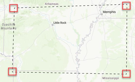
When creating a feature in ArcGIS Pro using the dashed stroke symbology, the feature displays misaligned lines and corners with gaps, as shown in the map below.

Cause
The Offset value is specified, which introduces gaps at the corners of the feature and causes misaligned dashed lines.
Solution or Workaround
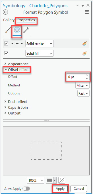
Remove the Offset value
- In the Contents pane, right-click the feature layer and click Symbology.
- In the Symbology pane, click the symbol to open the Format Symbol mode.
- In the Format Polygon Symbol pane, click the Properties tab and click Layers.
- Expand the Offset effect drop-down menu and specify the Offset value to be 0. Optionally, click Decrement until the value reaches 0.
- Click Apply. Optionally, toggle Auto Apply on, so changes can be applied automatically.
The map shows the feature maintaining the alignment of the dashed stroke symbology.
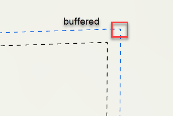
Use the Graphic Buffer tool
In ArcGIS Pro, use the Graphic Buffer tool to create a buffered copy of the feature instead of using an offset value. This approach helps smooth out gaps at corners caused by the offset effect in the dashed strokes by adding a small buffer around the graphic element, compensating for misalignments and recreating the offset effect.
The map shows the feature buffered according to the specified offset in ArcGIS Pro.
Article ID: 000034653
- ArcGIS Pro 3 3
- ArcGIS Pro 3 2
- ArcGIS Pro 3 4
Get support with AI
Resolve your issue quickly with the Esri Support AI Chatbot.


Related Information
Discover more on this topic
Search for related information
Find training related to this topic
Explore ideas and give feedback
Get help from ArcGIS experts
Start chatting now