PROBLEM
Camera orientation values not populated when images added to oriented imagery dataset in ArcGIS Pro
Description
An oriented imagery dataset manages a collection of oriented images stored on a local or network computer, or in publicly accessible cloud storages. In ArcGIS Pro, when images from the list of image paths in the Excel file are added to the oriented imagery dataset, the camera orientation values are not populated.
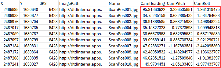
The image below shows the oriented imagery table in the Excel file, which contains all the camera values.
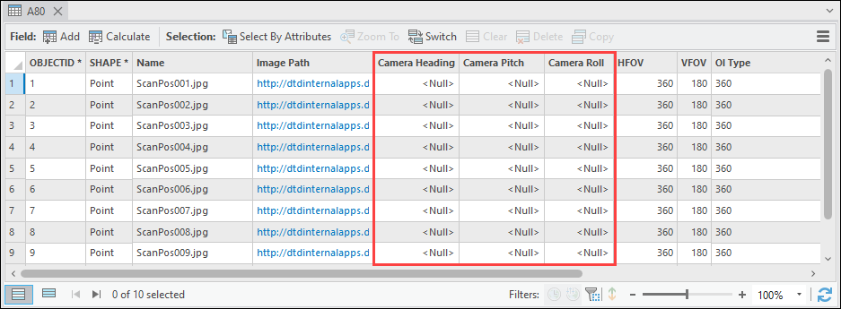
The image below shows the oriented imagery dataset attribute table without the camera values.
Cause
The oriented imagery table fields are not supported. The camera orientation values and other image metadata are only populated if the supported table fields are available and correctly named. Refer to ArcGIS Pro: Oriented imagery table fields for more information.
Solution or Workaround
Note:
The oriented imagery table field is case-sensitive. Ensure the name matches the supported field name, including capitalization and space.
Rename the oriented imagery table field in the Excel file
Rename the incorrect oriented imagery table field in the Excel file to the supported field before adding the images to the dataset using the Add Images To Oriented Imagery Dataset tool.
Rename the oriented imagery table field in ArcGIS Pro
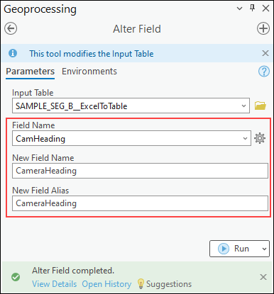
If the oriented imagery table is a file geodatabase table, use the Alter Field tool in ArcGIS Pro to rename the field and its alias, as shown in the image below. In this example, the file geodatabase table field is renamed from CamHeading to CameraHeading. Afterwhich, the modified table can be used as the input data in the Add Images To Oriented Imagery Dataset tool.
Article ID: 000033903
- ArcGIS Pro 3 1
- ArcGIS Pro 3 3
- ArcGIS Pro 3 2
Get support with AI
Resolve your issue quickly with the Esri Support AI Chatbot.


Related Information
Discover more on this topic
Search for related information
Find training related to this topic
Explore ideas and give feedback
Get help from ArcGIS experts
Start chatting now