PROBLEM
Buffer analysis fails with a warning and an error message in ArcGIS Pro
Description
In ArcGIS Pro, when running the Buffer tool with the 'Side Type' parameter set to 'Exclude the input polygon from buffer', the buffer analysis fails with a warning message and a general failure error message.
Warning:
000636: Skipping feature <value> because a negative or very small distance resulted in no geometry
Error:
00210: Cannot create output <file path>. Failed to execute (Buffer).
The buffer analysis is also time-consuming when performed on a large set of polygon feature class.
Cause
This issue may result from:
- A complicated geometry of the polygon feature class.
- A large dataset input.
- Using a negative or very small buffer distance.
Solution or Workaround
To resolve, use the Pairwise Buffer tool and the Erase tool to complete the buffer analysis.
Note:
When completing a buffer analysis, it is essential for the input polygon features to be excluded from the buffer. This does not apply when using the Pairwise Buffer tool. The Pairwise Buffer tool can be used with the Erase tool to exclude the input polygon feature from the buffer.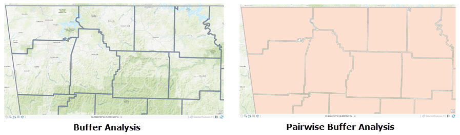
- In ArcGIS Pro, add the polygon feature class to the map.
- Add a spatial index to the polygon feature class.
- Select the Analysis tab, and click Tools.
- In the Geoprocessing pane, search for the Add Spatial Index tool.
- Select the polygon feature class for Input Features.
- Click Run.
- Run the buffer analysis using the Pairwise Buffer tool.
- In the Geoprocessing pane, search for the Pairwise Buffer tool.
- For Input Features, select the output feature class from Step 2.
- For Output Feature Class, specify a filename, and location.
- For Distance, specify the preferred buffer distance and Linear Unit. Optionally, specify Method, Dissolve Type, and Maximum Offset Deviation.
- Click Run.
Note:
The Side Type parameter is not available in the Pairwise Buffer tool.
- Remove the input polygon from the buffer polygon using the Erase tool. The steps below are applicable if a negative Distance is used in the buffer analysis with the Pairwise Buffer tool.
Note:
If the Distance parameter in the Pairwise Buffer tool is positive, specify the buffer polygon for Input feature, and specify the polygon feature class for Erase Feature.
- In the Geoprocessing pane, search for the Erase tool.
- For Input Features, select the polygon feature class.
- For Erase Features, specify the buffer polygon created in Step 3.
- For Output Erase Feature, specify a filename, and location. Optionally, specify XY Tolerence.
- Click Run.
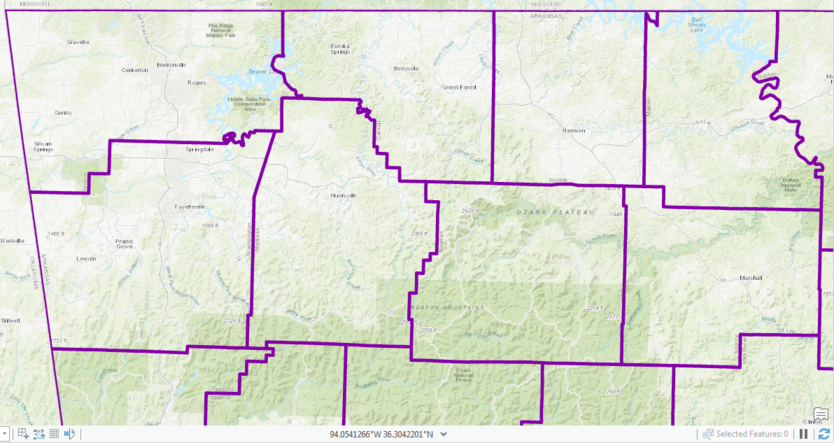
The image below shows the output after running the Pairwise Buffer tool and the Erase tool.
Article ID: 000023438
- ArcGIS Pro 2 x
Get support with AI
Resolve your issue quickly with the Esri Support AI Chatbot.


Related Information
Discover more on this topic
Search for related information
Find training related to this topic
Explore ideas and give feedback
Get help from ArcGIS experts
Start chatting now