PROBLEM
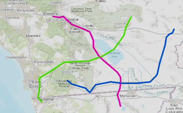
3D data lines with negative Z-values are visible above the ground surface in ArcGIS Pro
Description
When using the default symbology for 3D lines, the lines display according to the Z-values that denote elevation or depth. Lines with positive Z-values lie above the surface whereas lines with negative Z-values lie below the ground and are invisible on the map.
In some cases, 3D lines with both positive and negative values display above the surface in small scale. Lines with negative Z-values disappear, showing the actual elevation of the surface, only when the map is zoomed into large scale.
Cause
This problem may occur due to one of the following reasons:
- The 3D line cuts through the surface source due to the elevation variation.
- An incorrect 3D line style is used.
Solution or Workaround
Depending on the cause(s), select one of the options below to resolve the problem.
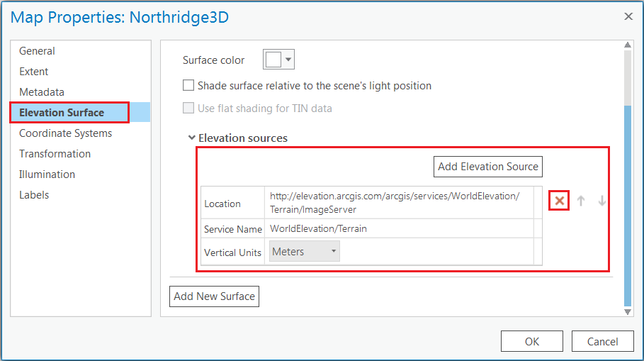
- In ArcGIS Pro, right-click the map in the Contents pane, and click Properties.
- In the Map Properties window, click the Elevation Surface tab on the left pane.
- Click the Remove elevation source button, and click OK.
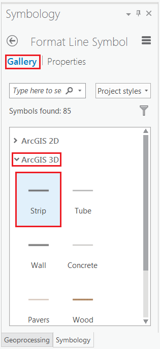
- In the Contents pane, click the line symbol for the line layer. The Symbology pane opens.
- On the Gallery tab, select the Strip line style under ArcGIS 3D.
- Click the Properties tab, and set the desired Color and Line width.
- Click Apply and close the Symbology pane.
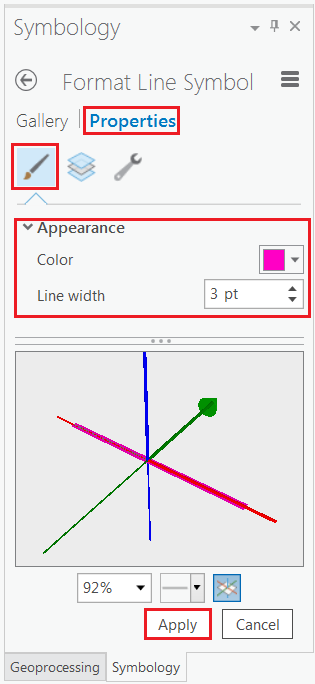
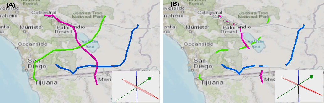
Note the difference between the Tube (A) and Strip (B) symbology as shown in the image below. The section of the lines with negative Z-values are no longer visible on the map surface when using the Strip symbology.
Article ID: 000014389
- ArcGIS Pro 1 x
Get support with AI
Resolve your issue quickly with the Esri Support AI Chatbot.


Related Information
Discover more on this topic
Search for related information
Find training related to this topic
Explore ideas and give feedback
Get help from ArcGIS experts
Start chatting now