HOW TO
Identify the optimized point location based on the distance from other points
Summary
A suitable location must be identified to place facilities. For example, nodes for internet access must be set up on certain streetlights with a specified distance of 500 feet between them. This means if a node is placed on a streetlight, the other streetlights within 500 feet do not require a node. Identifying an optimized location helps to determine the amount of nodes required and which streetlights require them.
The following instructions describe how to identify an optimized point location based on the distance from other points.
Procedure
Note:
Ensure each of the points has a unique ID number or identifier to get carried over through all the geoprocessing. ObjectID does not work in this workflow. For example: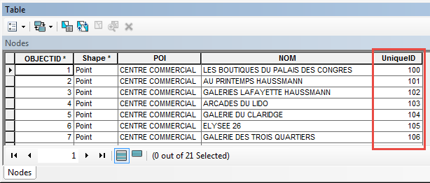
- Create a buffer of the specified distance around each point feature using the Buffer tool.
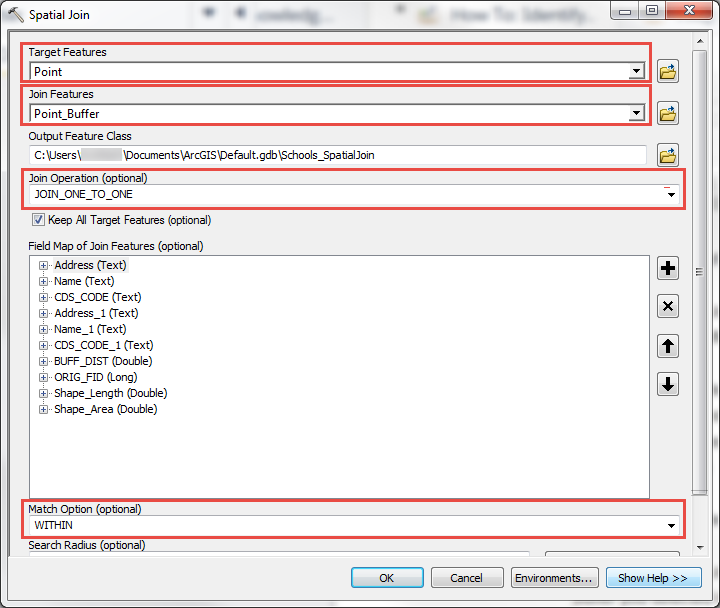
- Run the Spatial Join tool on the point feature and buffer feature.
- Select the point feature layer for the target feature.
- Select the buffer layer for the join feature.
- Select JOIN_ONE_TO_ONE for the join operation.
- Select WITHIN for the match option.
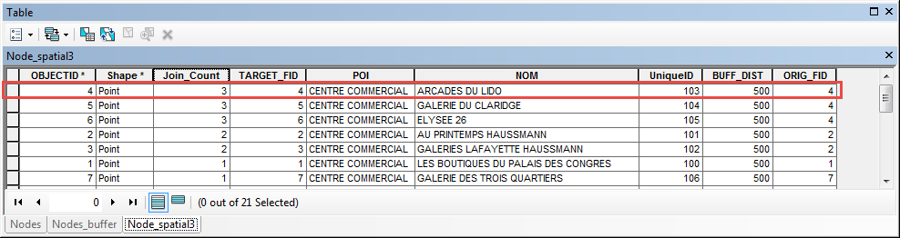
- Open the attribute table of the newly-created layer and sort by descending order on the Join_Count field.
Note:
Identify which point has the highest join count and make a note of the unique ID number/identifier. For any point with a count of 1, it can be safely assumed that a node is required on the point location, as there are no other features within the specified distance.
- In the buffer layer, select the buffer associated with the point found in Step 3 by searching for the unique ID or identifier associated to the feature.
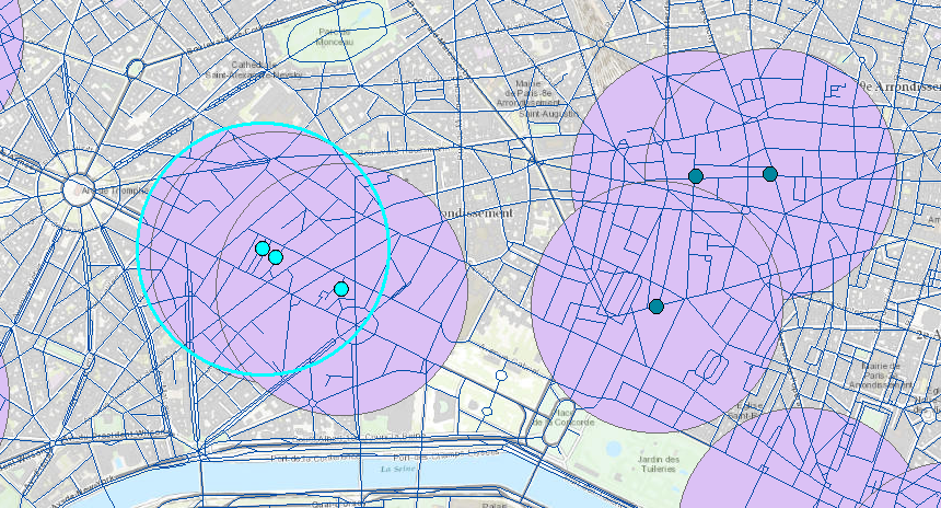
- Use the Select By Location tool to find all of the points that were generated in Step 2 located within the buffer selected in Step 4.
- Select the point feature layer created in Step 2 as the target layer.
- Select the buffer layer created in Step 1 as the source layer and check the Use selected features check box.
- Select are completely within the source layer feature as the spatial selection method.
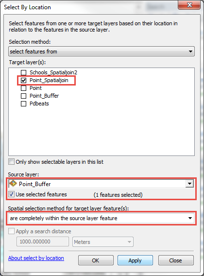
Note:
The image shows point features that reside within the specified distance of the point with the most neighboring points surrounding it.
- In the attribute table of point feature generated in Step 2, click Switch Selection
 to identify only the points that are not within the specified distance of this first point.
 - Export the selected list to a new feature class.
- Repeat Step 2 through 6 as needed until all features that require a node are identified.
Article ID: 000015557
- ArcMap
Get support with AI
Resolve your issue quickly with the Esri Support AI Chatbot.


Related Information
Discover more on this topic
Search for related information
Find training related to this topic
Explore ideas and give feedback
Get help from ArcGIS experts
Start chatting now