HOW TO
Identify the raster ID associated within a particular bounding box area in an image service
Summary
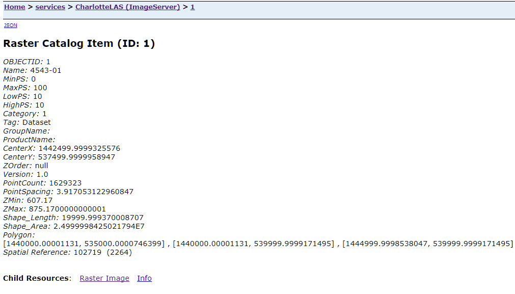
The Raster Catalog Item page provides details on a specific feature and its associated raster. To retrieve information, such as the object ID or raster ID associated within a particular bounding box (bbox) area in an image service, use the Query function in the REST endpoint for the service and use the bbox coordinates to specify the area.
Identifying the raster associated within the bbox area enables users to obtain only the relevant raster data for analysis. Furthermore, the information from the Raster Catalog Item page can be used in other geospatial software.
For more information about bounding boxes in ArcGIS REST API, refer to Export Map.
Procedure
The instructions provided describe how to retrieve the raster ID for a particular bounding box area in an image service.
- Open the REST page of the image service by accessing the image service URL.
- Click Query at the bottom of the page.

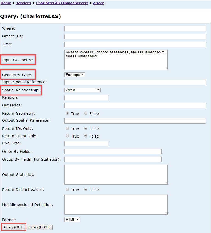
- Input the bbox coordinates for Input Geometry.
Note:
Bbox coordinates can be obtained through taking note of the coordinates of four points around an area of interest. For example, in this article, the bbox coordinates are 1440000.00001131 (XMin), 535000.0000746399 (YMin), 1444999.9998538047 (XMax), 539999.9999171495 (YMax).
- Set the Geometry Type parameter to Envelope.
- Set the Spatial Relationship parameter to Within.
- Click Query (GET).
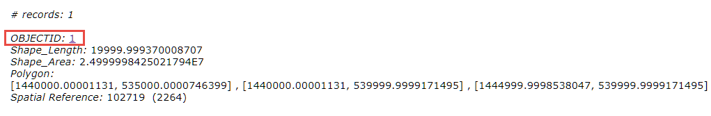
- Scroll to the bottom of the page to view the raster IDs associated with the bbox area. Clicking the ID redirects the user to the Raster Catalog Item page.
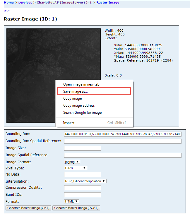
Note:
Additionally, to retrieve the raster image, click Raster Image at the bottom of the Raster Catalog Item page to view the queried image. Right-click the image > Save image as. The image is saved as a JPEG file.
Article ID: 000015262
- ArcGIS Online
- ArcGIS Server
Get support with AI
Resolve your issue quickly with the Esri Support AI Chatbot.


Related Information
Discover more on this topic
Search for related information
Find training related to this topic
Explore ideas and give feedback
Get help from ArcGIS experts
Start chatting now