HOW TO
Set the default extent when exporting a Business Analyst Web App map to PDF or an image
Summary
The Create PDF or image tool in Business Analyst Web App allows taking a screen capture of a map and saving it as a PDF file, or saving the current view as an image file. In some cases, the default extent must be set when exporting a map to PDF or as an image to ensure the exported file contains the data within a fixed desired extent. However, setting a fixed extent when saving a map to PDF or as an image is currently not supported in Business Analyst Web App.
The instructions provided describe an alternative to set the default extent when exporting a Business Analyst Web App map to PDF or an image by defining the default extent for the map. This provides the capability to zoom in to the defined area before exporting the map.
Procedure
- In Business Analyst Web App, open the project containing the map to export.
- Click the settings icon
 on the upper right of the application.
 - In the Preferences dialog box, click the General tab > Settings.
- Set the default map extent by entering the address of the location in the Zoom to Location text box. If required, drag the map in the Location Preview box to better fit the desired extent.
In this example, the location is zoomed to Minneapolis, Minnesota and the map in the Location Preview box is dragged to zoom to the desired extent.
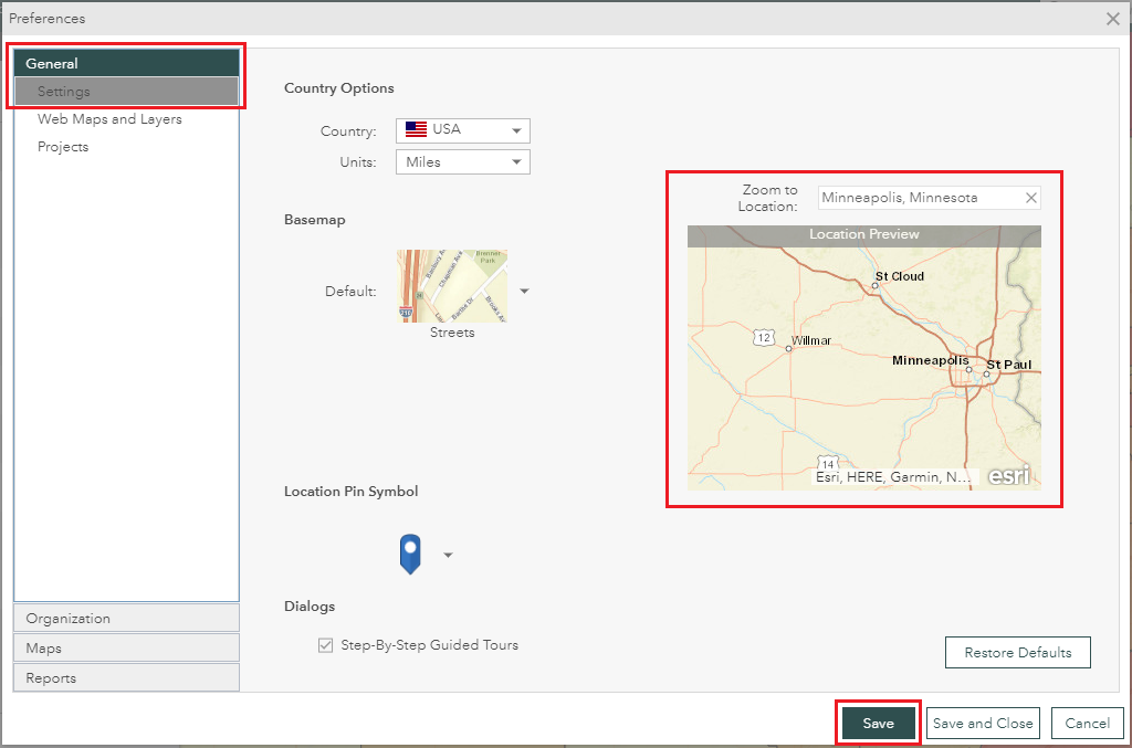
- Click Save > Save and Close to close the dialog.
- Refresh the application to enable the entered location.
Note:
Setting the map default extent in the Preferences dialog affects the map display in all projects.
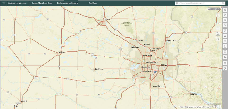
When reopening the application, the map displays the set default extent. The image below shows an example of the map display in the application after setting the map default extent to zoom to Minneapolis, Minnesota.
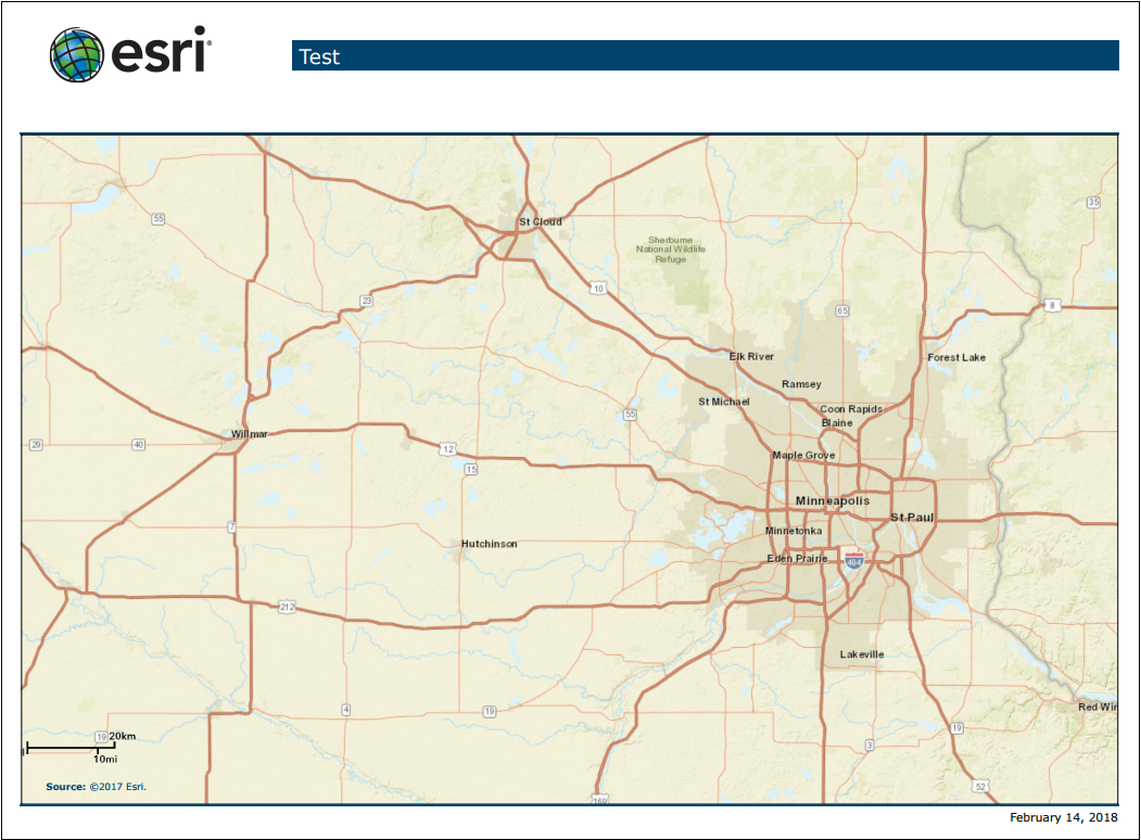
Exporting the map outputs a file displaying the map within the set default extent. The image below is an example of a PDF file exported from the map within the extent set as in the above image.
Article ID: 000017655
- ArcGIS Business Analyst Web App
Get support with AI
Resolve your issue quickly with the Esri Support AI Chatbot.


Related Information
Discover more on this topic
Search for related information
Find training related to this topic
Explore ideas and give feedback
Get help from ArcGIS experts
Start chatting now