HOW TO
Return a total feature count from a layer with data intersecting an area of interest in ArcGIS Experience Builder
Summary
A total feature count from a layer with data intersecting an area of interest can be returned in ArcGIS Experience Builder using the Near Me and Search widgets. This is useful to generate a report or statistics on the number of incidences or points of interest within a predefined area.
Procedure
Follow the steps below to return a total feature count from a layer with data intersecting an area of interest on a map in ArcGIS Experience Builder.
- Add and configure a Map widget. Refer to ArcGIS Experience Builder: Map widget for more information.
- Add a Near Me widget.
- On the left toolbar, click Insert
 to open the Insert widget panel.
 - In the Insert widget panel, under Map centric, drag and drop the Near Me widget on the canvas.
- Configure the settings in the Near Me panel.
- In the Near Me panel, on the Content tab, under Select a map widget, click the drop-down menu, and select a map.
- Under Analysis Settings, click the inserted map to open the map pane.
- Configure the settings in the map pane.
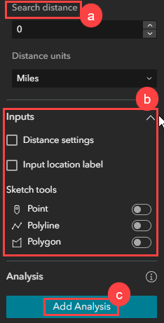
- In the map pane, under Search Method, set the Search distance to 0.
Note:
Setting the Search distance to 0 is necessary to return the points of interest within the searched area of interest only, not within a buffer area.
- Expand Input, uncheck the Distance settings and Input location label check boxes, and toggle Point, Polyline, and Polygon under Sketch tools off.
- Under Analysis, click Add Analysis to open the Edit Analysis pane.
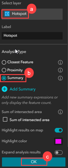
- Add a summary analysis for the polygon layer.
- In the Edit Analysis pane, for Select layer, click the layer name to open the layer list, and select the polygon layer.
- Under Analysis Type, check Summary.
- Click OK.
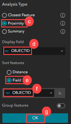
- Add a proximity analysis for the point layer.
- In the map pane, under Analysis, click the Add Analysis button.
- In the Edit Analysis pane, for Select layer, click the layer name to open the layer list, and select the point layer.
- Under Analysis Type, check Proximity.
- For Display Field, select OBJECTID.
- For Sort features, check Field.
- Below the Field option, click the drop-down arrow, and select OBJECTID.
- Click OK.
- Add a Search widget.
- On the left toolbar, click Insert to open the Insert widget panel.
- In the Insert widget panel, under Data centric, drag and drop the Search widget on the canvas to add a Search widget.
- Configure the settings on the Search widget Content tab.
- In the Search panel, on the Content tab, click New search source > Layer Source.
- In the Set layer source pane, click Select data.
- In the Select data pane, on the Added tab, click the Expand button next to the connected map to view the layer list, and select the polygon layer.
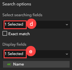
- In the Set layer source pane, under Search options, for Select searching fields, expand the drop-down list, and select the field to be used as a search input. In this example, the Name field is selected.
- For Display fields, select the same field selected in Step 8(d).
- Configure the settings on the Search widget Action tab.
- In the Search panel, on the Action tab, click the Add a trigger button.
- In the Select a trigger pane, click Record selection changes.
- In the Select a target pane, under Widgets, click Near Me.
- In the Select an action pane, click Set location.
- On the builder toolbar, click the Save
 and Preview
  buttons to save and preview the experience.
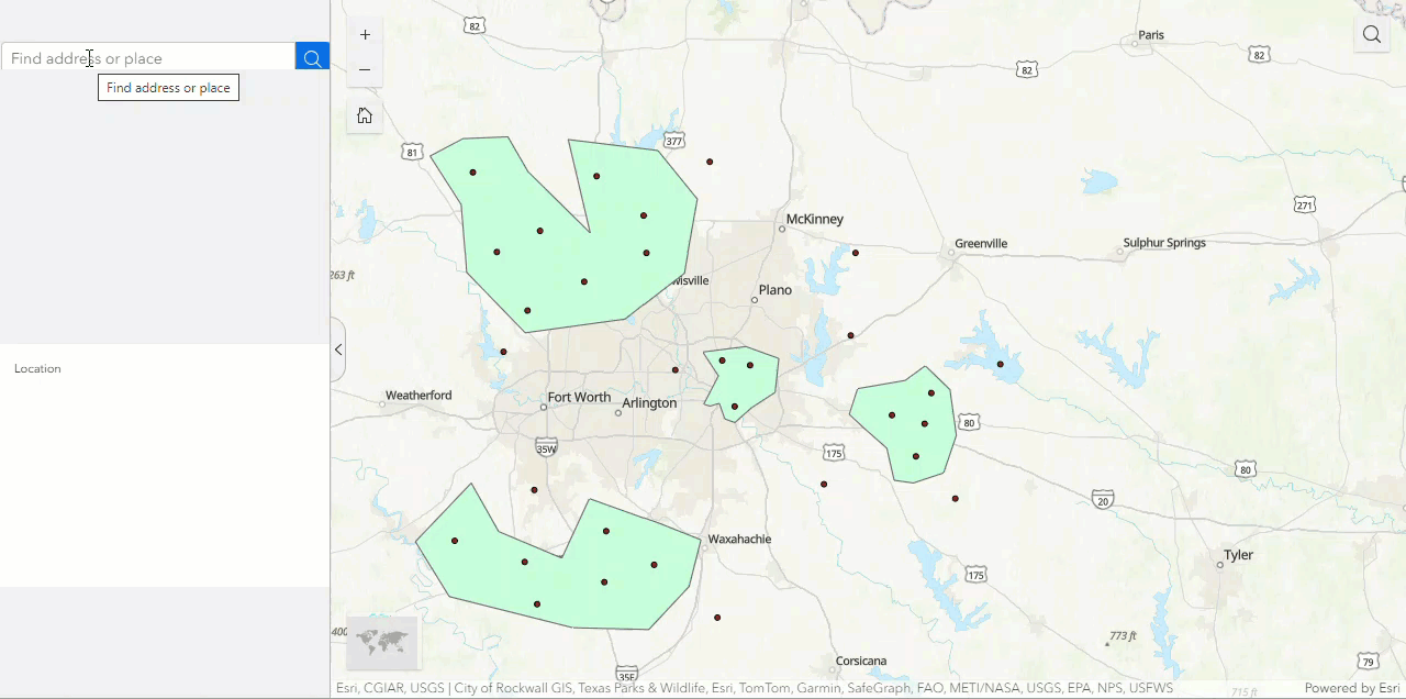
The image below shows the number of intersecting features in an experience when searching an area of interest in the Search widget.
Article ID: 000032482
- ArcGIS Experience Builder
Get support with AI
Resolve your issue quickly with the Esri Support AI Chatbot.


Related Information
Discover more on this topic
Search for related information
Find training related to this topic
Explore ideas and give feedback
Get help from ArcGIS experts
Start chatting now