HOW TO
Retrieve the JSON of a specific layer in a feature service using ArcGIS API for Python
Summary
The JSON of a feature service layer contains information such as the layer's geometry type, min and max scales, and spatial reference. The Python script provided in this article can be used to access the JSON of a feature service layer.
Procedure
- Import the necessary modules.
import arcgis
- Specify the credentials to connect to the portal.
gis = arcgis.gis.GIS("<portal_URL>", "<username>", "<password>", verify_cert=False)
- Specify the item ID and layer ID of the service to be queried.
item = gis.content.get("<portal_itemID>")
resturl = dict(item)["url"]
layerurl = str(resturl) + "/" + str(<item_layerID>)
layer = arcgis.features.FeatureLayer(layerurl)
- Print the JSON properties.
print(layerurl+"?f=pjson")
print(layer.properties)
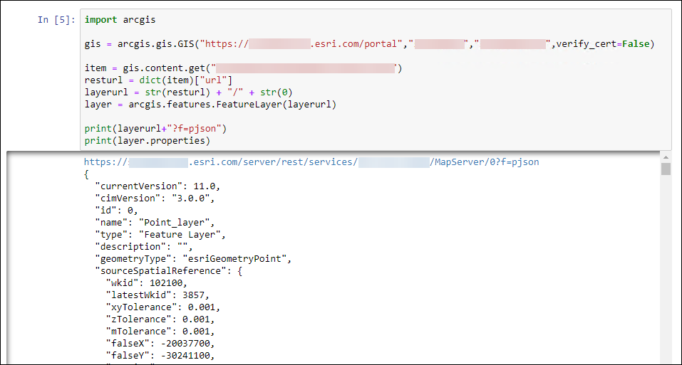
The code block below demonstrates the full script.
import arcgis

gis = arcgis.gis.GIS("https://machines.esri.com/portal", "username1", "password1", verify_cert=False)

item = gis.content.get("asd651cqe84c6d51a")
resturl = dict(item)["url"]
layerurl = str(resturl) + "/" + str(0)
layer = arcgis.features.FeatureLayer(layerurl)

print(layerurl+"?f=pjson")
print(layer.properties)
The JSON of the specific feature service layer is returned after running the script.
Article ID: 000030408
- Portal for ArcGIS
- ArcGIS Server
- ArcGIS API for Python
- ArcGIS Enterprise 10 x
- ArcGIS Enterprise 11 0
- ArcGIS Enterprise 11 1
Get support with AI
Resolve your issue quickly with the Esri Support AI Chatbot.


Related Information
Discover more on this topic
Search for related information
Find training related to this topic
Explore ideas and give feedback
Get help from ArcGIS experts
Start chatting now