HOW TO
Retain zeros after decimal points in ArcMap attribute table fields
Summary
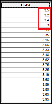
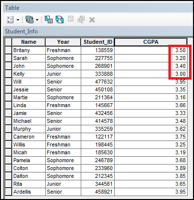
It is sometimes necessary to retain zeros after decimal points in ArcMap attribute table field values. In this article, the CGPA records of university students must be rounded to two decimal places; however, the zeros after the decimal point are not displayed. For example, 3.50 is displayed as 3.5, and 3.00 is displayed as 3.
Procedure
To retain zeros after a decimal point in an attribute table field value in ArcMap, enable the Pad with zeroes option from the Number Format dialog box as described in the workflow below.
-
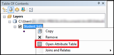
In Table Of Contents, under Layers, right-click the layer, and click Open Attribute Table.
-
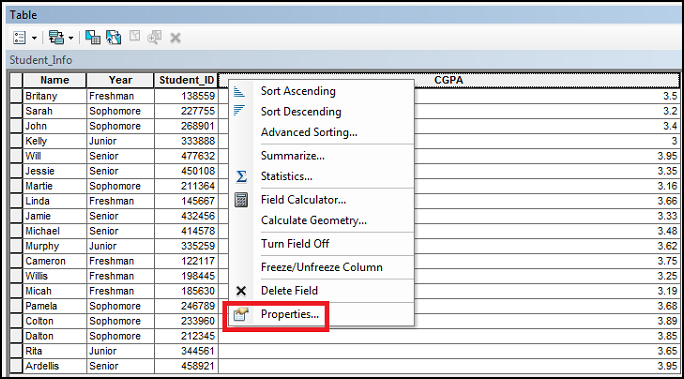
In the attribute table, right-click the field heading, and click Properties... to open the Field Properties dialog box.
-
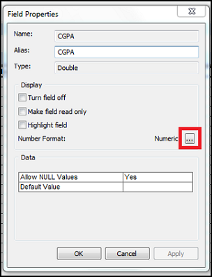
Click the Number Format ellipsis
 button.
-
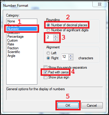
In the Number Format dialog box, select Numeric from the Category list.
-
Select Number of decimal places under Rounding, and type the number of decimal places. In this example, 2 is entered.
-
Check the Pad with zeros option.
-
Click OK to close the Number Format and Field Properties dialog boxes.
The image below shows zeros displayed after decimal points.
Article ID: 000023900
- ArcMap
Get support with AI
Resolve your issue quickly with the Esri Support AI Chatbot.


Related Information
Discover more on this topic
Search for related information
Find training related to this topic
Explore ideas and give feedback
Get help from ArcGIS experts
Start chatting now