HOW TO
Plan a flight in ArcGIS Flight without Wi-Fi or cellular network access
Summary
Drones provide an effective tool for gathering aerial imagery over large areas in a rapid manner. Several scenarios may require planning a drone flight for instances of no internet connection:
- Flying a site with insufficient access to Wi-Fi or a cellular network
- Planning a flight for others to fly at a different location
- Planning a flight in the office to be flown at a later date
- Ensuring data are collected the same way every time
- Saving a completed flight to fly again
Procedure
The following workflows describe how to plan for a flight without Wi-Fi or cellular network access.
From the home screen:
- Update ArcGIS Flight to the newest version.
- Open the app on the iPad.
- Select an existing project, or create a new one within your organization.
- From the project home screen, select Flight Plans.
- Under Create New Flight Plan select a flight mode.
- Provide a name for your Flight Plan and Mission
Note:
The flight plan is a path the drone will follow over a defined area (e.g., Orchard Survey). The mission is a specific completion of the flight plan (for example, July Flight).
- Type the address or closest city in the Mission Location box, or use the map to pan and zoom to the specific flight area.
- Click Next → in the bottom left corner to go to the Mission Settings screen.
- Drag the vertices (white circles) for the flight polygon to cover your area of interest. Add vertices to the flight polygon by tapping the smaller white circles between existing vertices.
- Adjust settings within the Mission Settings to customize your mission. Additional visual flight path settings can be accessed in the Advanced section at the bottom of the settings list.
- Camera Projections can be enabled by tapping the settings button (gear icon) in the lower left corner of the map viewer. This displays the camera location & orientation of each photo to be taken during flight.
- After finalizing flight settings select Save Flight Plan in the top right corner.
- Your saved flight plan can now be found under the Flight Plans menu on the project home screen.
From the Mission Complete Screen After flight:
- After the drone lands, from the Mission Complete screen select Save Flight Plan.
- Your flight plan is now saved to the Refly tab of the Flight Plans menu. It can be reflown in future missions.
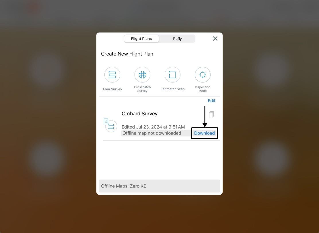
Note:
It is advised to download the offline basemap for missions without internet connection. This allows pilots to reference basemap aerial imagery, providing additional context to the flight plan to ensure safe operations in remote areas.
To download offline basemaps for flight plans:
- From the flight plans menu select Download for the desired flight plan.
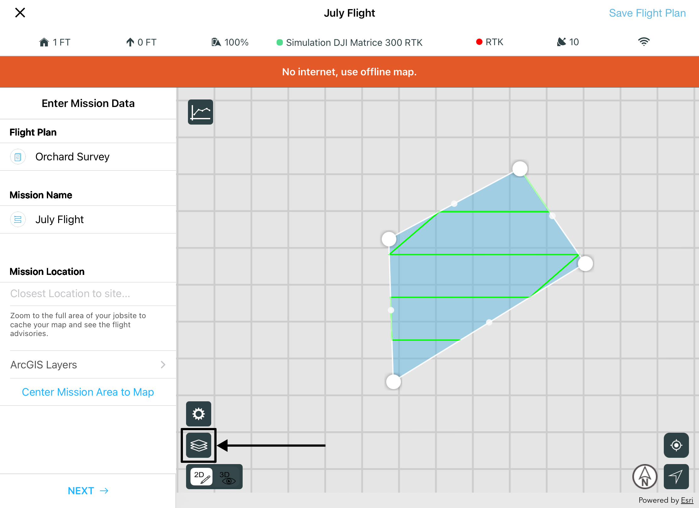
- After download is complete, select your flight plan from the flight plans list.
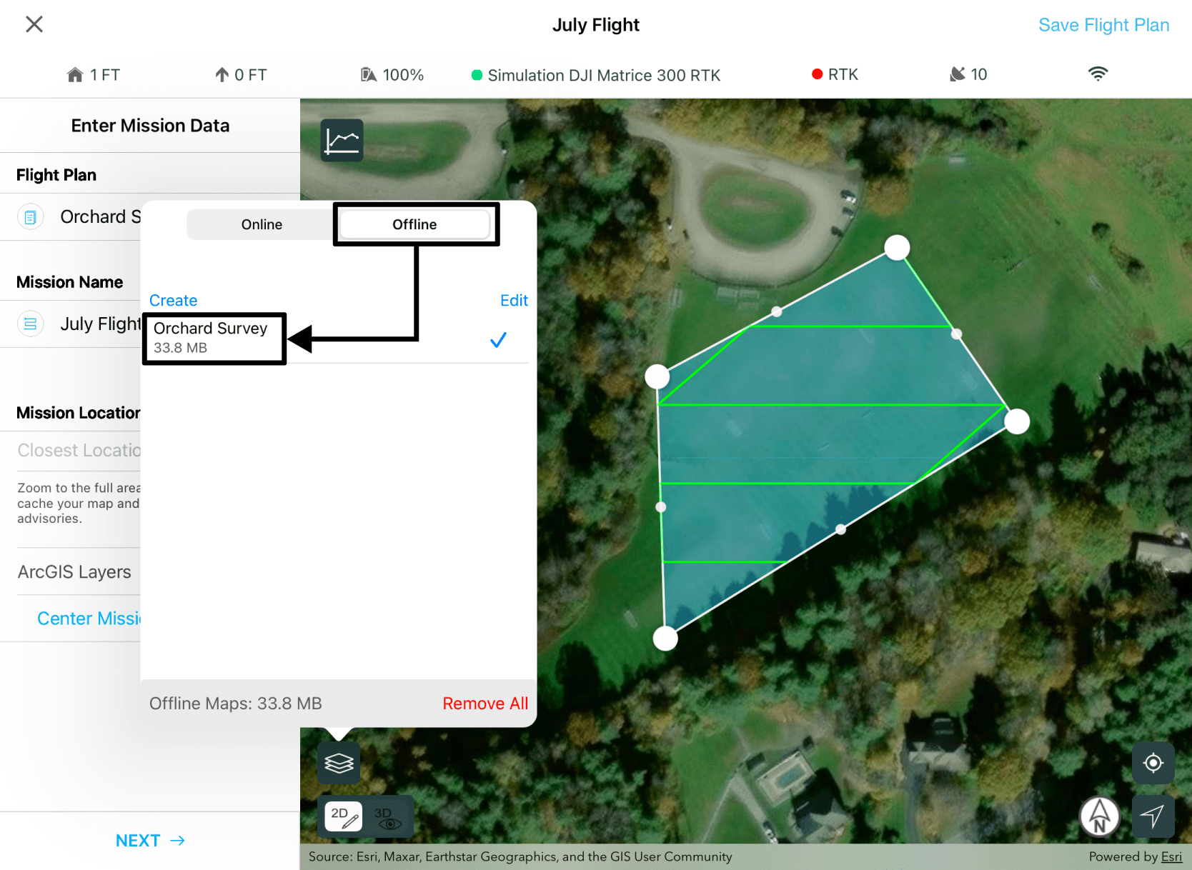
- Select the basemap layer of the map viewer.
- Click the Offline layer menu and select your flight plan to activate its offline basemap.
Article ID: 000023044
- Mobile Applications
- Site Scan Manager for ArcGIS
Get support with AI
Resolve your issue quickly with the Esri Support AI Chatbot.


Discover more on this topic
Search for related information
Find training related to this topic
Explore ideas and give feedback
Get help from ArcGIS experts
Start chatting now