HOW TO
Find point clusters in ArcGIS Online
Summary
In ArcGIS Online, multiple point features on a map are grouped based on their spatial distribution using the Find Point Clusters tool. For example, to identify fire activity distribution in an area, to find the epicenter of an earthquake, or to determine the source of spread of pest-borne diseases in an area.
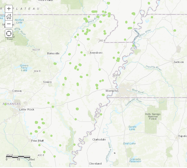
This article describes how to group the closest fire hotspots so as to determine the largest clusters of fires in the Midwestern United States.
Procedure
To use the Find Point Clusters tool, follow these steps:
Note:
Running this tool consumes credits. Refer to ArcGIS Online: Understand credits for more information.
- In ArcGIS Online Map Viewer, click the Analysis button
 on the map menu bar.
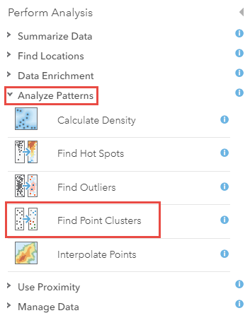
 - Expand the Analyze Patterns toolset drop-down menu, and click the Find Point Clusters tool.
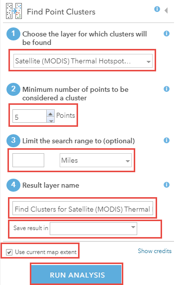
- Specify the point feature layer that must be clustered by clicking the drop-down menu of the Choose the layer for which clusters will be found field.
- Specify the number of points for the Minimum number of points to be considered a cluster field.
- Optionally, for the Limit the search range to (optional) field, specify the maximum radius for the same cluster of features, and select the unit from the drop-down menu.
Note:
Leaving this field blank causes the tool to run the Self-adjusting (HDBSCAN) algorithm, which uses varying distances to separate clusters of varying densities from sparser noise. On the other hand, entering a value causes it to run the Defined distance (DBSCAN) algorithm, which uses a specified distance to separate dense clusters from sparser noise. Refer to ArcGIS Pro: Density-based Clustering for more information.
- Name the output layer, and specify the save location in the Save result in drop-down menu under the Result layer name field.
- Optionally, check the Use current map extent option.
Note:
If the Use current map extent option is checked, only features in the input point layer of the current map extent are analyzed. If unchecked, all the features are analyzed, even though they fall outside the current map extent.
- Click Run Analysis.
Note:
To ascertain the number of credits consumed, click the Show credits option at the bottom of the Find Point Cluster pane.
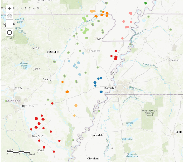
The image below shows the fire point features grouped into different clusters by color.
Article ID: 000022071
- ArcGIS Online
Get support with AI
Resolve your issue quickly with the Esri Support AI Chatbot.


Related Information
Discover more on this topic
Search for related information
Find training related to this topic
Explore ideas and give feedback
Get help from ArcGIS experts
Start chatting now