HOW TO
Export ArcMap data to a CAD file in a different coordinate system
Summary
The Export to CAD tool exports feature classes and shapefiles to CAD files in V8 DGN and DWG/DXF formats. The tool creates one or more CAD drawings based on the values contained in one or more input feature classes or feature layers and supporting tables. The output CAD files also export the coordinate system, a feature class schema that defines the CAD feature classes, and the attribute information.
This article describes how to export a feature class or shapefile to a CAD file in a different coordinate system.
Procedure
Note:
This workflow is not suitable for exporting a geodatabase annotation feature class to a CAD file.
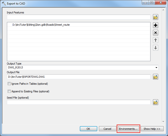
- In ArcMap, use the Export to CAD tool to export the feature class or shapefile to a CAD file.
- In the Export to CAD dialog box, for Input Features, select the data to be converted.
- For Output Type, select a CAD format.
- For Output File, set a name and location of the output CAD file.
- Click Environments.
- In the Environment Settings dialog box, click to expand Output Coordinates.
- For Output Coordinate System, select As Specified Below.
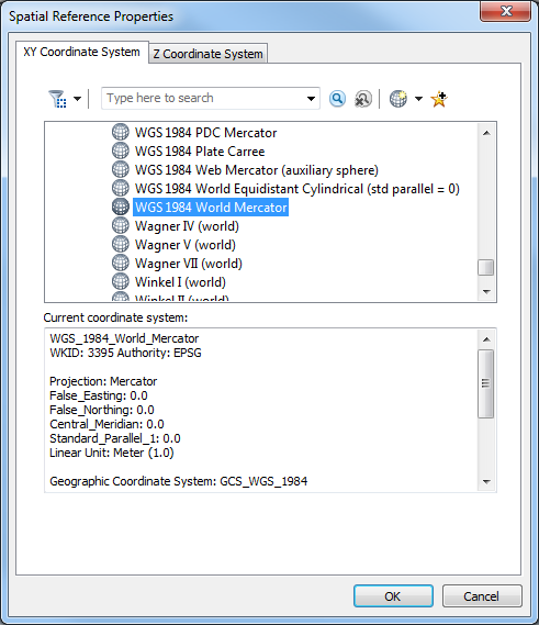
- In the Spatial Reference Properties dialog box, find and select the desired coordinate system, and click OK.
- For Geographic Transformations, select a transformation in the drop-down list. For more information on choosing the correct transformation, refer to the following article: How To: Select the correct geographic (datum) transformation when projecting between datums
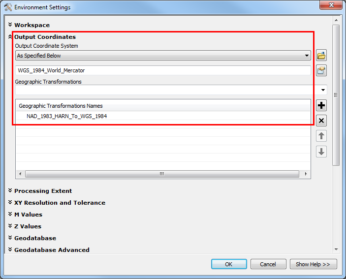
- Click OK to close the Environment Settings dialog box.
- Click OK to run the tool.
- In AutoCAD, add or import the CAD file and assign the coordinate system to the file. Refer to To Assign a Coordinate System to the Current Drawing for steps to do this.
Article ID: 000022221
- ArcMap
Get support with AI
Resolve your issue quickly with the Esri Support AI Chatbot.


Related Information
Discover more on this topic
Search for related information
Find training related to this topic
Explore ideas and give feedback
Get help from ArcGIS experts
Start chatting now