HOW TO
Export a map as an interactive PDF in ArcGIS Pro
Summary
In ArcGIS Pro, maps can be exported as an interactive PDF. An interactive PDF allows layer visibility toggling, distance measuring, and enables viewing of selected attributes of a feature on the fly. Interactive PDFs store all the map information in a single file, making it a useful medium for sharing content when a network connection is not available. This article describes the steps to export a map as an interactive PDF in ArcGIS Pro.
Procedure
- Open the ArcGIS Project.
- On the Share ribbon tab, click Export Map.
- In the Export Map pane, for File Type, select PDF from the drop-down menu.
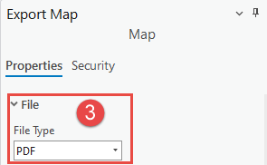
Note:
Under Compression, ensure the Output as image check box is unchecked.
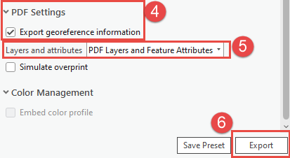
- Under PDF Settings, check the Export georeference information check box.
- In the Layers and attributes drop-down menu, select PDF Layers and Feature Attributes.
- Click Export.
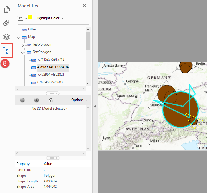
- Open the exported PDF in Adobe Acrobat Reader DC.
- Click Model Tree: Work with 3D objects in the navigation pane and expand the map layers.
The feature layer’s attribute table can now be viewed and interacted with in the PDF viewer as shown in the image below.
Article ID: 000027943
- ArcGIS Pro 3 0
- ArcGIS Pro 2 8 x
- ArcGIS Pro 2 x
Get support with AI
Resolve your issue quickly with the Esri Support AI Chatbot.


Related Information
Discover more on this topic
Search for related information
Find training related to this topic
Explore ideas and give feedback
Get help from ArcGIS experts
Start chatting now