HOW TO
Dynamically filter data in a List widget based on the map view
Summary
The ArcGIS Experience Builder documentation for the the List widget states that "You can also set actions for a List widget to interact with other widgets in your app, such as zooming to the selected feature on a map in a Map widget or displaying the selected feature’s attributes in a Feature Info widget."
This article provides the steps to configure the List widget to display only the items in the extext of the map view.
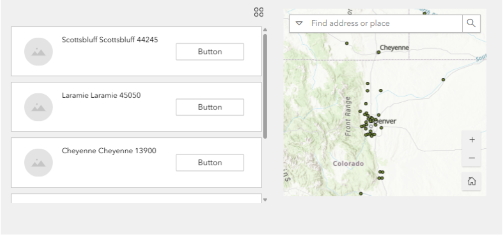
When you interact with the map by zooming in, zooming out, or panning, the list widget automatically reorders itself. It prioritizes and displays features that are currently visible within the map's extent, ensuring that the list always reflects what's on your screen.
Procedure
- Create a web map with the layer you want to view in ArcGIS Experience Builder.
- Create a new ArcGIS Experience Builder application, and add the web map as the data source inside the ArcGIS Experience Builder application.
- Add a Map widget to the experience and select the same web map. This serves as the primary visual element for displaying the spatial data.
- Add a List widget to display the features from the Map widget.
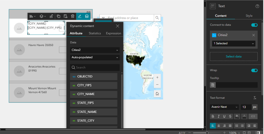
- Open the configuration panel for the List widget and select the data source that corresponds to the features displayed on the Map widget.
- Edit the text inside the List widget to add the dynamic attributes from the layer.
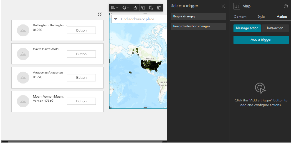
- Click the Map widget to open the configuration panel. In the Action tab, add a trigger for Extent changes. This trigger activates whenever the map's extent is altered, for example, when a user zooms in or pans across the map.
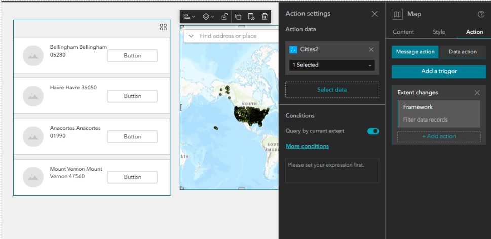
- Under the Extent changes trigger, select Framework, and select the action to Filter data records and select the map layer. This ensures that the List widget displays only the features that are currently within the visible extent of the Map widget .
- After setting up the triggers and actions, preview your experience. Interact with the Map widget by zooming in and out or panning to ensure that the List widget updates correctly based on the features visible in the map frame.
Article ID: 000036490
- ArcGIS Experience Builder
Get support with AI
Resolve your issue quickly with the Esri Support AI Chatbot.


Related Information
Discover more on this topic
Search for related information
Find training related to this topic
Explore ideas and give feedback
Get help from ArcGIS experts
Start chatting now