HOW TO
Determine the number of point features within a specified distance in ArcGIS Online
Summary
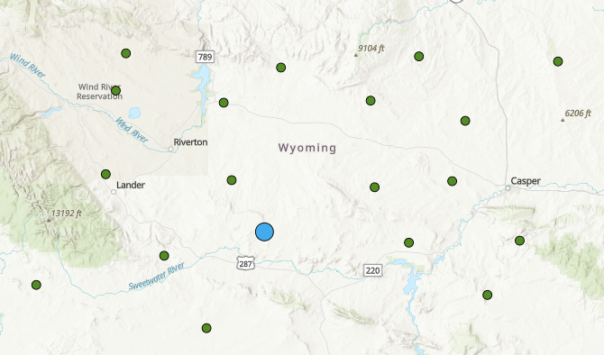
In ArcGIS Online, counting the number of point features within a specified distance is a common task. For example, counting the number of police stations within a 100-kilometer radius from the headquarters. The image below shows several police stations in Wyoming, U.S., mapped in green, and the headquarters in blue.
This article describes how to determine the number of police stations within a 100-kilometer radius of the headquarters in ArcGIS Online.
Procedure
Note:
Performing this workflow consumes credits. Refer to ArcGIS Online: Understand credits for more information.
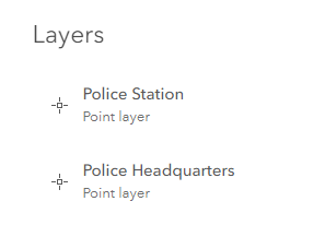
- In ArcGIS Online Map Viewer Classic, open the point feature layers published from ArcGIS Pro. In this example, the layers are the Police Station and Police Headquarters locations.
- Navigate to Analysis > Perform Analysis > Use Proximity > Create Buffers.
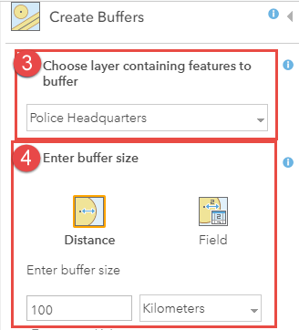
- In the Create Buffers pane, select the layer from the Choose layer containing features to buffer drop-down. In this example, Police Headquarters is selected.
- In the Enter buffer size option, specify the distance to create the buffer. In this example, a buffer of 100 kilometers from the Police Headquarters is specified.
- Click RUN ANALYSIS.
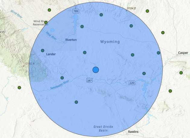
The image below shows the buffered area of the Police Headquarters feature layer.
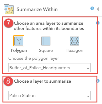
- Navigate to Analysis > Perform Analysis > Summarize Data > Summarize Within.
- In the Summarize Within pane, select the buffered layer of the Police Headquarters from the Choose the polygon layer drop-down.
- For Choose a layer to summarize, select the Police Station feature layer.
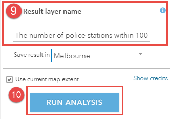
- Specify the Result layer name.
- Click RUN ANALYSIS.
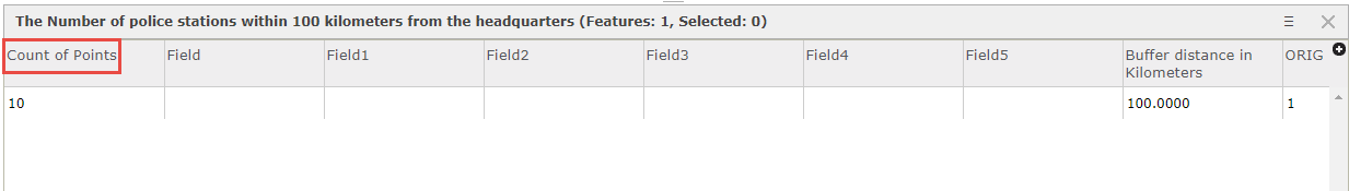
- Navigate to Details > Content. In the Content pane, browse to the summarized feature layer and click Show Table.
The Count of Points column in the table displays the number of the police stations within 100 kilometers of the police headquarters. In this example, the total Count of Points is 10, as shown in the image below. The output shows there are 10 police stations within 100 kilometers from the headquarters in Wyoming, U.S.
Article ID: 000027850
- ArcGIS Online
Get support with AI
Resolve your issue quickly with the Esri Support AI Chatbot.


Related Information
Discover more on this topic
Search for related information
Find training related to this topic
Explore ideas and give feedback
Get help from ArcGIS experts
Start chatting now