HOW TO
Determine the intersecting area between a parcel fabric and a non-parcel fabric polygon layer
Summary
The intersecting area between a parcel fabric and a non-parcel fabric polygon layer can be determined in ArcMap. This is useful in determining the total area of properties affected by natural disaster or human-caused damage, such as a flooding event, crop lands affected by toxic waste, or a neighborhood impacted by a forest fire.
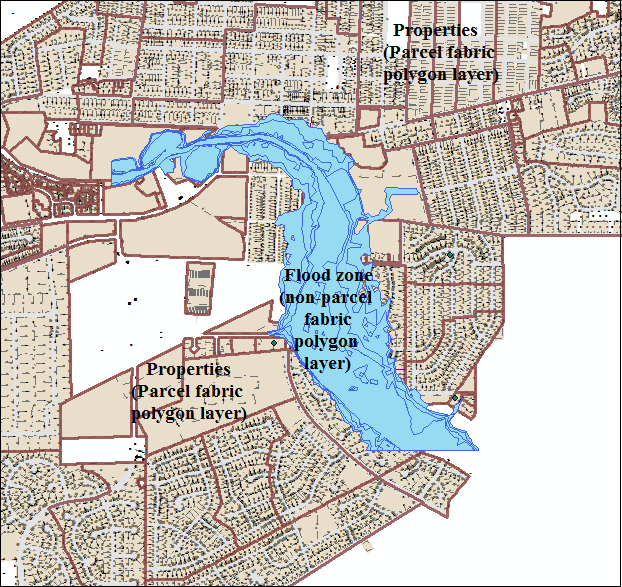
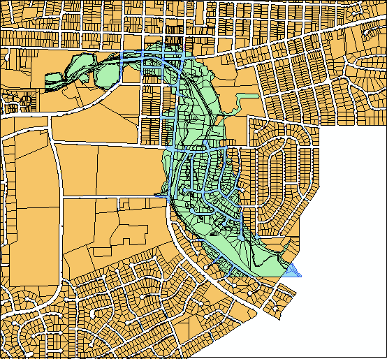
For example, the image below shows a neighborhood in Naperville, Illinois, which is affected by a flooding event. The parcel fabric represents the properties and the non-parcel fabric polygon layer represents the flood zone. This article describes how to calculate the total area of properties affected by the flooding.
Procedure
The following workflow describes how to determine the intersecting area between a parcel fabric and a non-parcel fabric polygon layer:
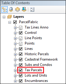
- In ArcMap, a parcel fabric is shown as a group layer with several feature layers within the parcel fabric. Navigate to Table Of Contents, and export the Tax Parcels layer of a parcel fabric to a feature class. For more information on exporting layers, refer to ArcMap: Creating a new feature class by saving the contents of a map layer in ArcMap.
- In the Export Data dialog box, navigate to the Output feature class field, and click the Browse button. Specify the Save as type field as a feature class and locate the desired geodatabase.
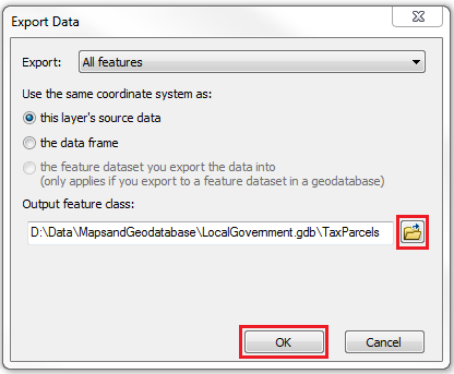
A polygon feature class is created from the Tax Parcels layer in the parcel fabric.
Note:
The recently-created polygon (tax parcels) layer is located at the top of Table Of Contents. For easier data visualization, turn off the fabric group layer and position the recently-created polygon (tax parcels) layer below the non-parcel fabric polygon (flood zone) layer.
- Navigate to Geoprocessing > Intersect.
- In the Intersect dialog, set the Input Features to the polygon feature class created from the tax parcels layer in Step 2, and the polygon layer representing the flood zone. For more information on the Intersect tool, refer to ArcMap: Intersect.
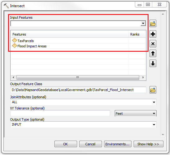
- Click OK.
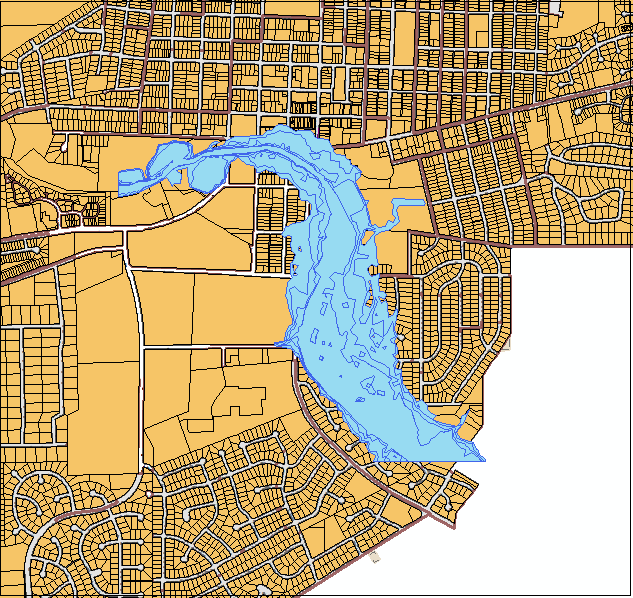
An intersection of the two feature classes is generated as a new feature class, added as a layer in Table Of Contents, and symbolized in a different color in the map view as in the image below.
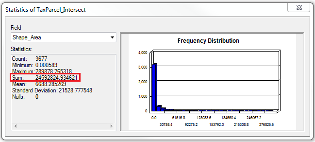
- In Table Of Contents, right-click the intersecting layer generated. Click Open Attribute Table.
- In the attribute table, right-click the Shape_Area field header, and click Statistics. The Sum field shows that the intersecting area of properties affected by the flood zone is 24,592,824 square feet. For more information, refer to ArcMap: Viewing statistics for a table.
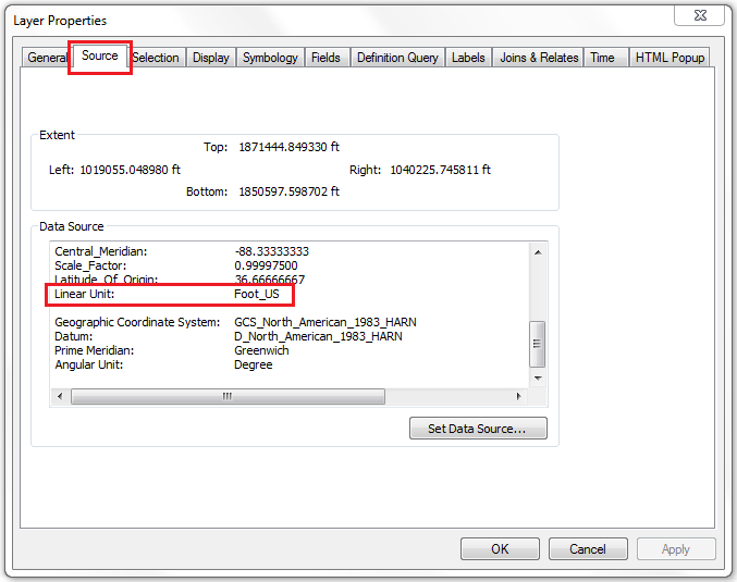
Note:
The output unit of the Statistics calculation depends on the layer unit, which is determined by right-clicking the specified layer from Table Of Contents, and clicking Properties. In the Layer Properties dialog box, click the Source tab and scroll down to the Linear Unit field. (See the image below.) The Linear Unit field specifies the layer unit, while the area is expressed in a square linear unit.
Article ID: 000018376
- ArcMap
Get support with AI
Resolve your issue quickly with the Esri Support AI Chatbot.


Related Information
Discover more on this topic
Search for related information
Find training related to this topic
Explore ideas and give feedback
Get help from ArcGIS experts
Start chatting now