HOW TO
Change point colors based on zoom levels in Portal for ArcGIS and ArcGIS Online Map Viewer
Summary
In Portal for ArcGIS and ArcGIS Online, it may be necessary to dynamically change the colors of point features based on different zoom levels. This is to enhance the interpretability of maps such as contextual information to represent the data density of a location.
This article describes the workflow to change point colors based on zoom levels in Portal for ArcGIS and ArcGIS Online Map Viewer.
Procedure
- Open the map containing the point layer in Portal for ArcGIS or ArcGIS Online Map Viewer.
- Duplicate the desired point layer. Refer to Portal for ArcGIS: Duplicate a layer or ArcGIS Online: Duplicate a layer for instructions.
- Click the duplicated point layer to open its Properties pane.
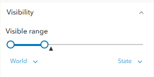
- Under Visibility, set the Visible range to display when the point layer is zoomed out.
- Specify the symbology color of the point layer. Refer to Portal for ArcGIS: Apply a style or ArcGIS Online: Apply a style for instructions.
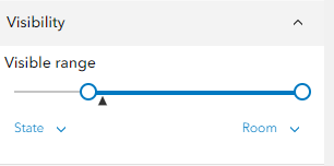
- Repeat Steps 3 through 5 for the original point layer when the layer is zoomed in.
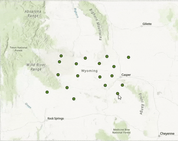
The point colors are changed when the map is zoomed in or out, as demonstrated in the image below.
Article ID: 000031672
- ArcGIS Online
- Portal for ArcGIS
Get support with AI
Resolve your issue quickly with the Esri Support AI Chatbot.


Related Information
Discover more on this topic
Search for related information
Find training related to this topic
Explore ideas and give feedback
Get help from ArcGIS experts
Start chatting now