HOW TO
Calculate the driving time between locations in ArcGIS Online Map Viewer Classic
Summary
In ArcGIS Online Map Viewer Classic, the driving time between locations can be calculated to estimate the time of arrival driving from one location to the other.
This article provides the workflow on how to measure the driving time between pairs of points using the Connect Origins to Destinations tool in Map Viewer Classic. In this example, the driving time between Point A and different Drop-off Points is calculated.
Procedure
- Log in to ArcGIS Online and open the map in Map Viewer Classic.
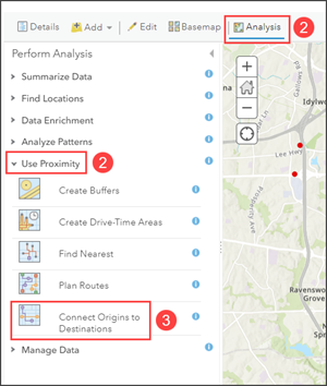
- Navigate to the Analysis tab, under Perform Analysis, click Use Proximity.
- Expand Use Proximity, and click Connect Origins to Destinations.
- In the Connect Origins to Destinations pane, configure the following parameters:
- For Choose point layer representing the origin locations, select the layer of origin. In this example, Point A is selected.
- For Route to destinations in, select the layer of destinations. In this example, Drop-off Points is selected.
Note:
Refer to ArcGIS Online: Usage notes for different connections that can be created between origins and destinations.
- For Measure, click the drop-down arrow and select Driving Time.
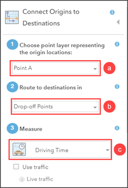
Note:
Check the Use traffic check box to enable the Live traffic option. Refer to ArcGIS Online: How Connect Origins to Destinations works for more information.
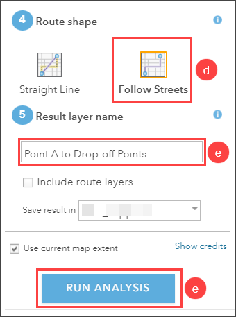
- For Route Shape, select the shape of the route to connect the origin-destination pair. In this example, Follow Streets is selected.
- For Result layer name, specify a name for the output layer and click RUN ANALYSIS.
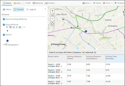
The driving routes from Point A to Drop-off Points are represented with different colors on the map.
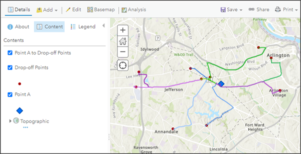
- In the Content tab, hover over the output layer and click Show table to open the layer's attribute table. The driving time of each origin to destination route is displayed in the Driving Time (Minutes) column.
Article ID: 000028840
- ArcGIS Online
Get support with AI
Resolve your issue quickly with the Esri Support AI Chatbot.


Related Information
Discover more on this topic
Search for related information
Find training related to this topic
Explore ideas and give feedback
Get help from ArcGIS experts
Start chatting now