HOW TO
Apply Grayscale to specific rasters in a mosaic dataset in ArcGIS Pro
Summary
In ArcGIS Pro, mosaic datasets are commonly used to manage large collections of raster datasets. When working with mosaic datasets, applying raster functions is a standard practice to enhance visualization and analysis. One such function is Grayscale, which converts a multiband raster into a single-band grayscale image by applying specified weights to the red, green, and blue (RGB) channels.
This article provides the workflow to apply the Grayscale function only to a specific raster within a mosaic dataset. This approach is particularly useful when a dataset contains various image sources, but only certain rasters require the grayscale conversion.
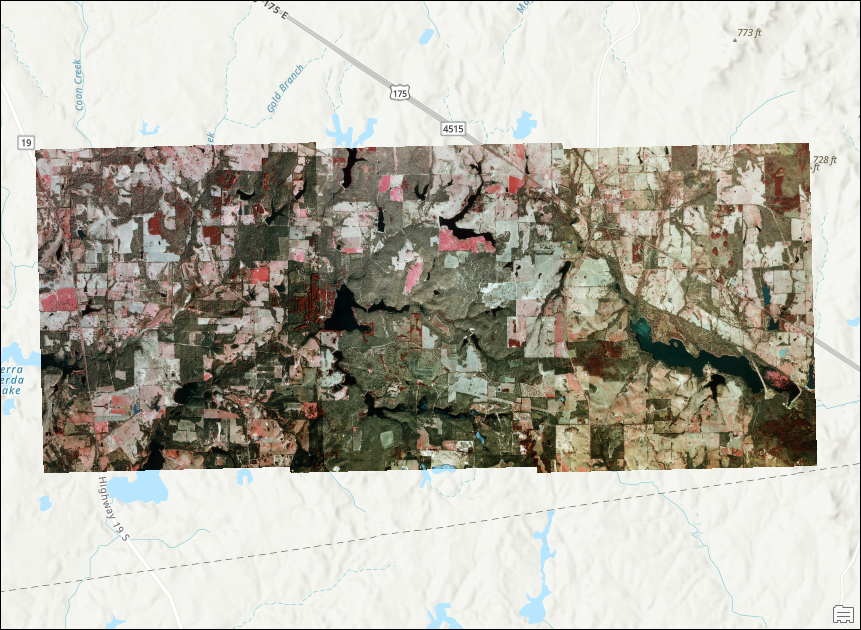
The map displaying the mosaic dataset with colored imagery below is used to demonstrate the workflow.
Procedure
- Open the project in ArcGIS Pro.
- Use the Explore Raster Items to filter the raster datasets in the mosaic dataset and select only the desired raster to be converted into a grayscale image. Refer to ArcGIS Pro: Raster Item Explorer for instructions.
- In the Raster Item Explorer pane, on the Inspect tab, click Item Functions
 to open the Raster Function Editor window.
 - In the Raster Function Editor window, click Raster Functions
 .
. - In the Raster Functions pane, click System > Conversion and drag Grayscale into the Raster Function Editor window. Refer to ArcGIS Pro: Access the Function Editor for more information.
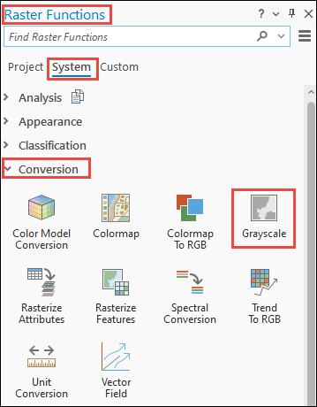
- In the Raster Function Editor window, click RasterInfo and drag the handle to Grayscale to connect the elements.
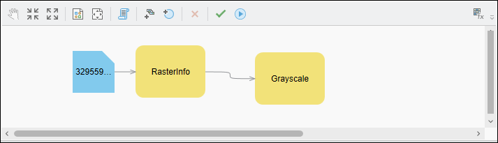
- Click Validate
 and click Apply
  .
.
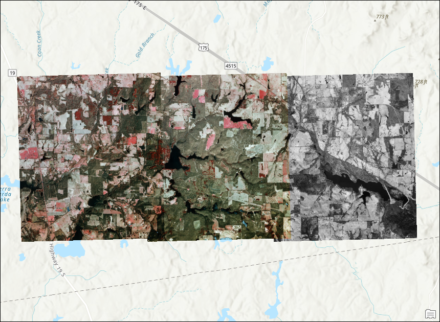
The map below displays the single raster in grayscale within the mosaic dataset.
Article ID: 000034871
- ArcGIS Pro 3 3
- ArcGIS Pro 3 2
- ArcGIS Pro 3 4
Get support with AI
Resolve your issue quickly with the Esri Support AI Chatbot.


Related Information
Discover more on this topic
Search for related information
Find training related to this topic
Explore ideas and give feedback
Get help from ArcGIS experts
Start chatting now